Topographic studies: what they are and when they are needed

Every construction project starts from an exact knowledge of the land, and topographic studies provide precisely that foundation: they measure the reality on the ground in national coordinates, so that the building rises on a solid base. Requested by the city hall, by the institutions issuing permits or by the investor, topographic studies are indispensable for the building permit and for urban planning documentation. This article explains what they are, what information they contain and when they are needed.
What topographic studies are
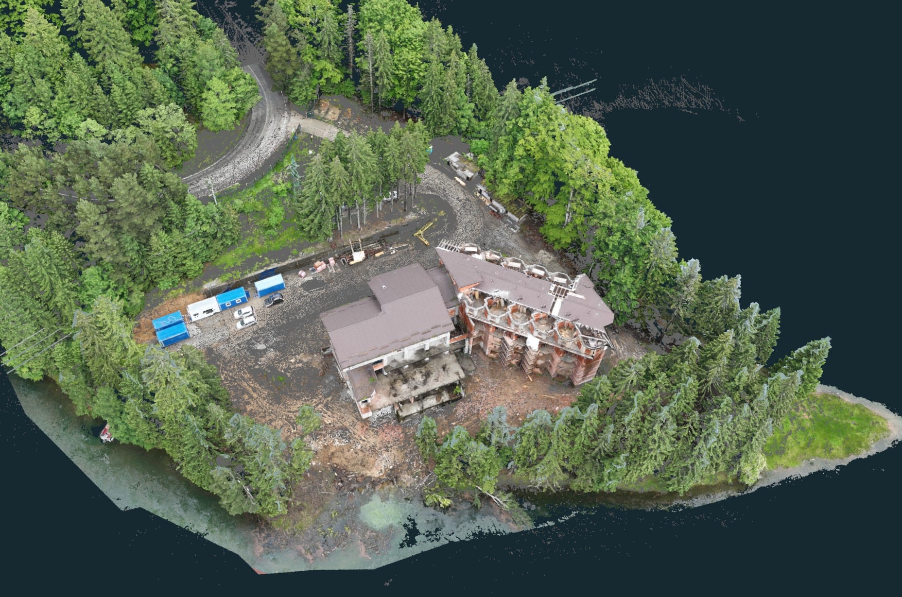
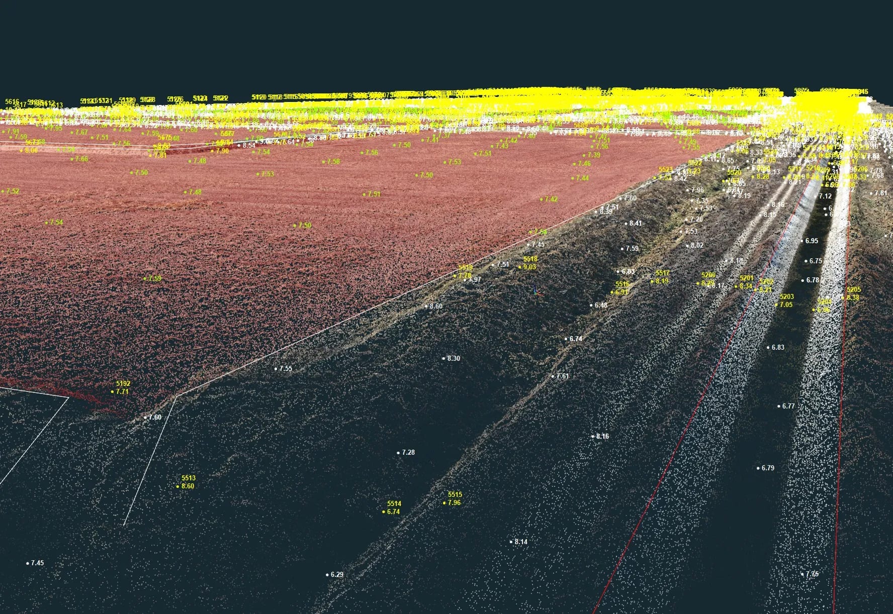
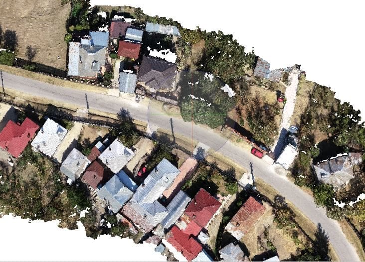
Topography is the science of measurement — determining the position of elements on a surface and representing them graphically. Topographic studies present the reality on the ground, measured in national coordinates (Stereo 70). On that basis, technical designs are laid out on site in accordance with the initial plans, and the foundation type best suited to the surveyed land can be decided. They are usually produced by cadastre and registration firms that have topographic engineers on the team, or by authorised topographers.
What information a topographic study provides
Topographic studies provide information relevant both to the authorities and to the project’s beneficiaries, and they allow the land and existing buildings to be entered into the cadastre. Among them:
- the boundaries of the plot and the level differences of the land;
- the location and size of neighbouring buildings;
- the shape and dimensions of the future building;
- the position of the utility networks in the area.
When topographic studies are needed
The main situations in which they are required:
- for a lease contract;
- in the sale or purchase process;
- for utility connections (water, sewerage, gas, electricity);
- to obtain the building or demolition permit;
- to convert a plot from outside the built-up area into intra-urban land;
- for the allocation of a postal number.
Conclusion
Given their role in obtaining permits and authorisations, topographic studies must be produced only by professionals, who comply with all the requirements set by the authorities. For a correct topographic study, produced in national coordinates, contact us.