Surveying & cadastre in Argeș
Topographic surveys and cadastral documentation in Pitești, Argeș and across Romania, by ANCPI-authorised staff in the Stereo 70 reference system — from topographic surveys and design-ready plans to cadastre and land-book registration.
Topographic surveys
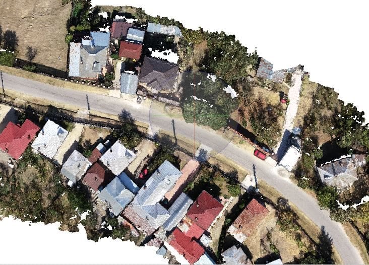
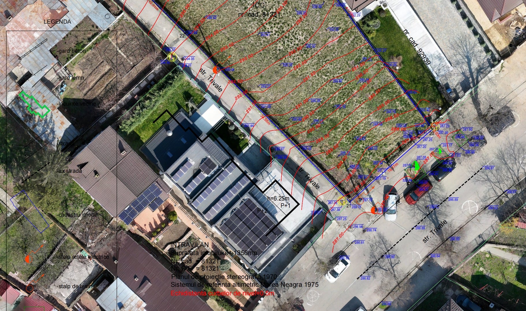
A topographic survey is the precise measurement of the land — relief, boundaries and detail — in the Stereo 70 reference system, delivered as a topographic plan. It is required for building permits, zoning (PUZ/PUD), design, utility connections, or as the basis for cadastral documentation.
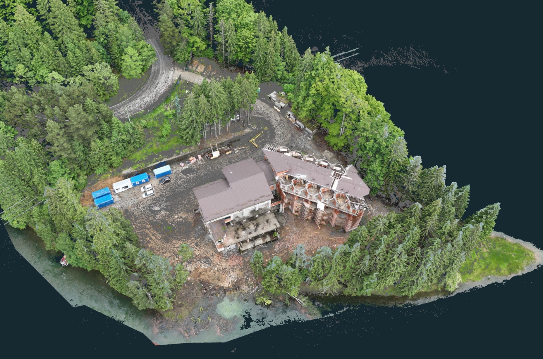
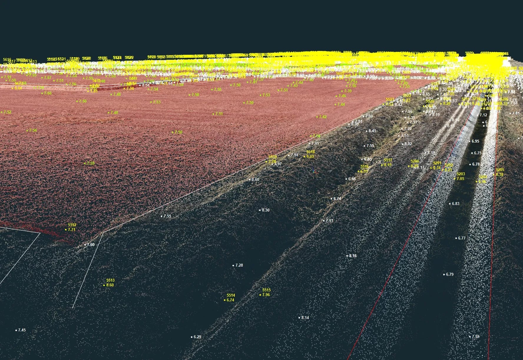
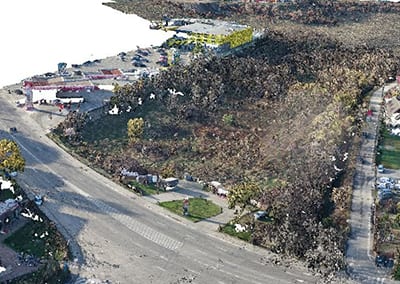
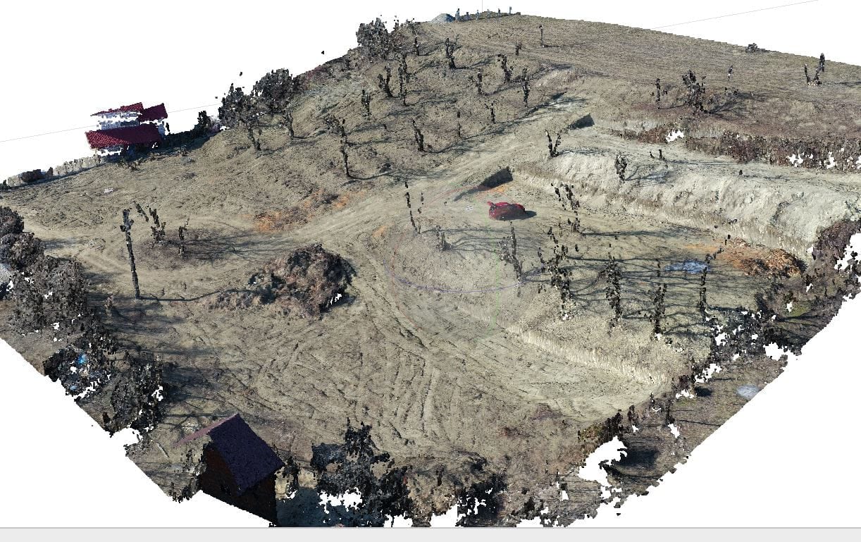
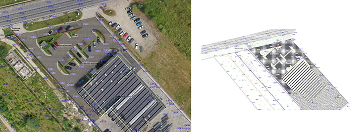
Topographic surveys include digital terrain (DTM), height (DHM) and surface (DSM) models with a high point density. The data come from LiDAR flights and photogrammetric captures, processed into a dense 3D point cloud. Every model is ready to use for GIS, CAD and planning workflows.
Ready-to-use products
- Digital height models (DHM): topography as a network of classified points, each point with a height value.
- Digital terrain models (DTM): the actual ground surface — ground points only, without buildings or vegetation.
- Digital surface models (DSM): include buildings and vegetation for a complete representation of heights.
Formats and representations
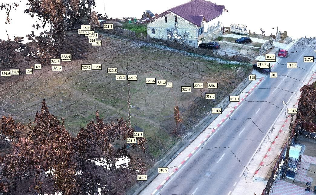
- Spot heights / grid: XYZ heights delivered as classified or filtered point clouds.
- Contour lines: connect points of equal elevation on topographic maps and geospatial datasets.
- Raster elevation models: the terrain as a raster image, encoded by colour or grey value.
- Polygon mesh: triangulated or hybrid networks, with breaklines for notable terrain changes.
- Terrain profile: derived from a DTM or point cloud, shows elevation along a profile line.
Land surveys
We carry out precise field measurements with a total station and GNSS (GPS) receivers in the Stereo 70 reference system — the basis for any topographic or cadastral documentation and for design plans.
What we deliver
- Topographic plan in Stereo 70 (DWG/DXF)
- XYZ coordinate inventory
- Support for design, zoning (PUZ/PUD) and permitting
Cadastre & land registration
Cadastre means measuring the property and preparing the technical documentation (plan and cadastral number), while land registration (intabulare) records the ownership right in the Land Book — usually done together at first registration. The documentation is needed for a sale, inheritance, subdivision, merging, or to authorise a construction.
We prepare the cadastral documentation and register the property in the Land Book. The work is carried out by ANCPI-authorised staff, in line with the Cadastre and Land Registration Law no. 7/1996 and the Regulation approved by ANCPI Order no. 700/2014.
Cadastral operations
- First registration — assigning the cadastral number and registering the property (land and/or building) in the Land Book for the first time.
- Subdivision — splitting a property recorded in the Land Book into two or more properties, each with its own cadastral number.
- Merging — joining two or more adjacent properties into a single property.
- Cadastral update — recording changes: a new building, a change of area or boundaries, repositioning, change of land-use category.
- Land registration (intabulare) — recording a real right (e.g. the ownership right) in the Land Book.
What we deliver
- Property location and delimitation plan
- Cadastral documentation accepted by OCPI
- Cadastral number and Land-Book registration
- Land-book extract (after registration)