3D laser scanning in Argeș
Terrestrial, mobile and aerial 3D laser scanning in Argeș and across Romania — point clouds, as-built surveys and building sections, 3D models and CAD export, for architects, designers and developers.
3D laser scanning
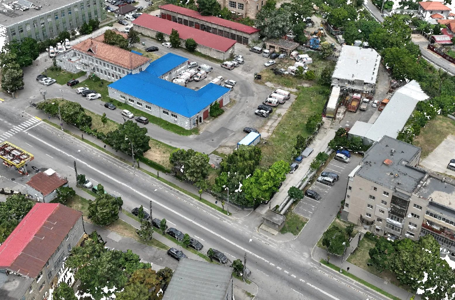
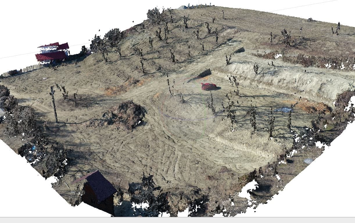
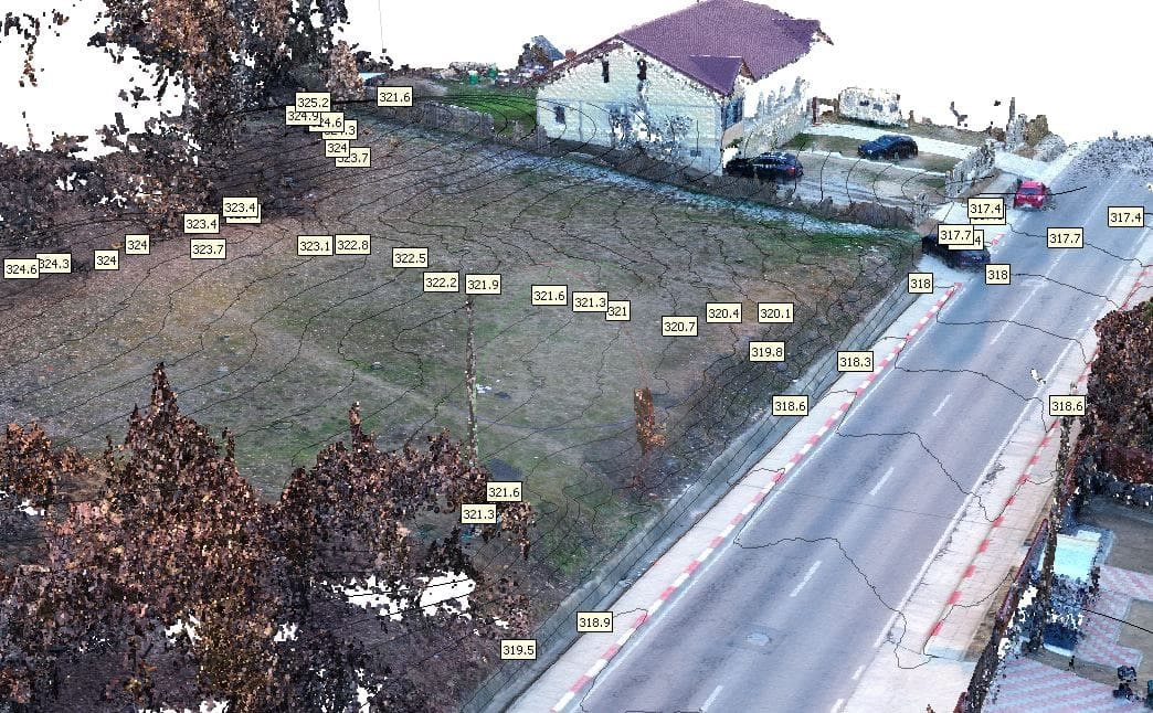
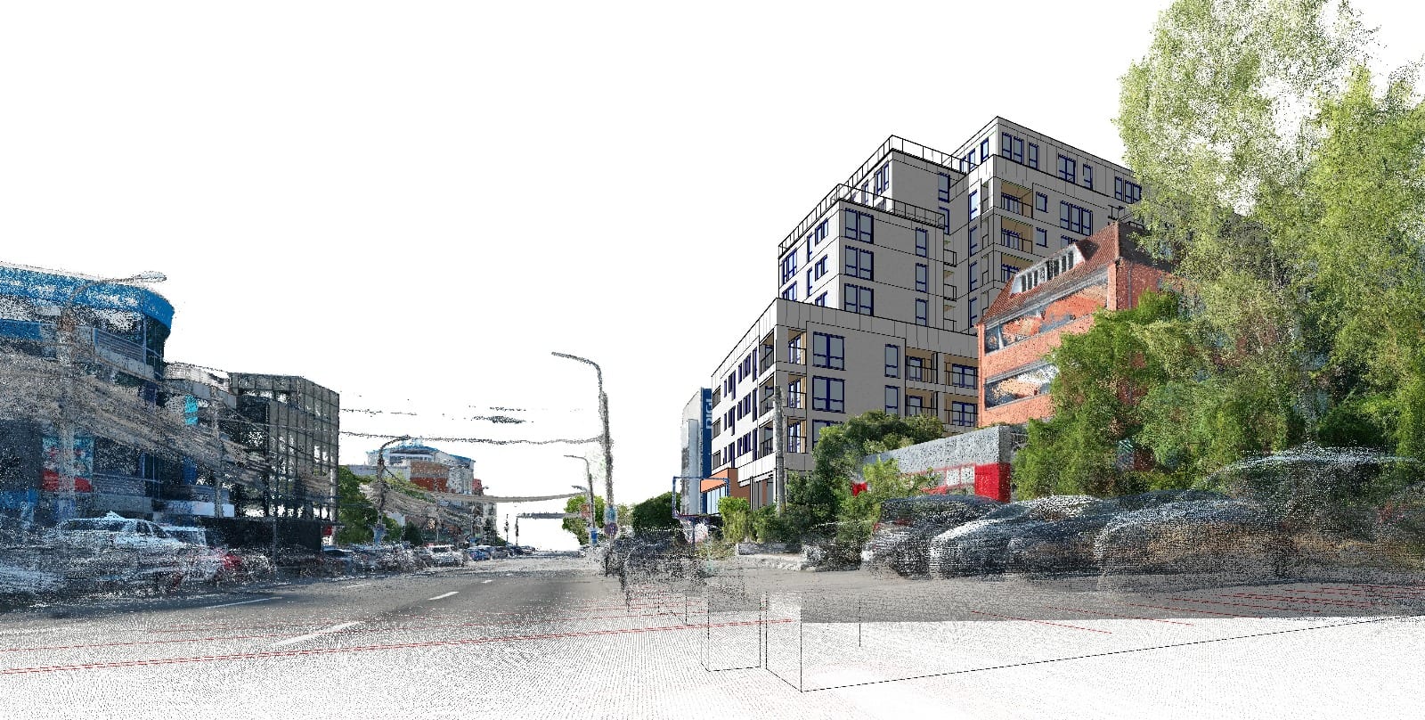
3D laser scanning measures an object, building or site as millions of precise points — a 3D point cloud. From it we produce as-built surveys, sections, 3D models and CAD plans, useful for documenting existing buildings, heritage, industrial halls or for as-built design.
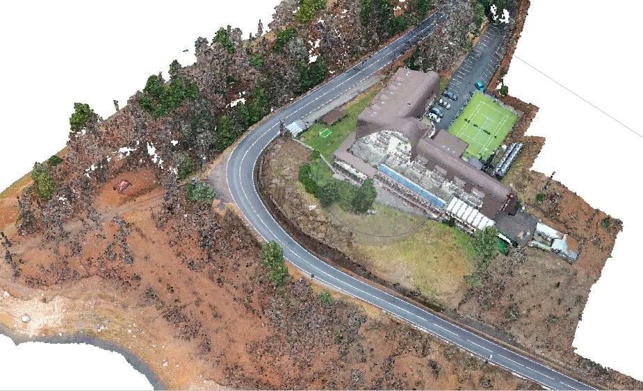
We offer multiple forms of laser scanning. Alongside 3D models built from drone imagery, we specialise in mobile laser scanning: current LiDAR systems and SLAM algorithms open up unprecedented possibilities for 3D data capture and analysis. We capture objects, buildings and sites completely and quickly — from the inside, the outside and from above.
Mobile laser scanning is contactless yet accurate. The advantage of SLAM-based systems (simultaneous localisation and mapping) is that they don't need GPS for orientation; the scans are aligned at processing time. That makes them well suited to remote areas, indoor spaces and even underground environments.
Terrestrial 3D scanning
- Digital terrain models (DTM)
- Digital surface models (DSM)
- Orthophotos
- Detailed topographic plans
- 3D models of structures and buildings
- CAD documentation
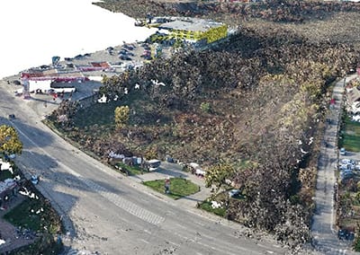
Aerial 3D scanning with drones
- Digital terrain models (DTM)
- Digital surface models (DSM)
- High-resolution orthophotos
- Interactive 3D maps
- Volumetric analysis and measurements
- Construction progress monitoring and reporting
Mobile 3D scanning (vehicle-mounted)
- Detailed 3D models of urban infrastructure
- Enriched GIS databases
- 3D maps for advanced navigation
- Simulations for infrastructure design
- Safety and visibility analysis
Indoor 3D scanning for buildings
- Floor plans and cross-sections
- Interactive 3D walkthroughs of the interior
- Space analysis and layout planning
- Documentation for renovations and retrofitting
- Emergency evacuation simulations
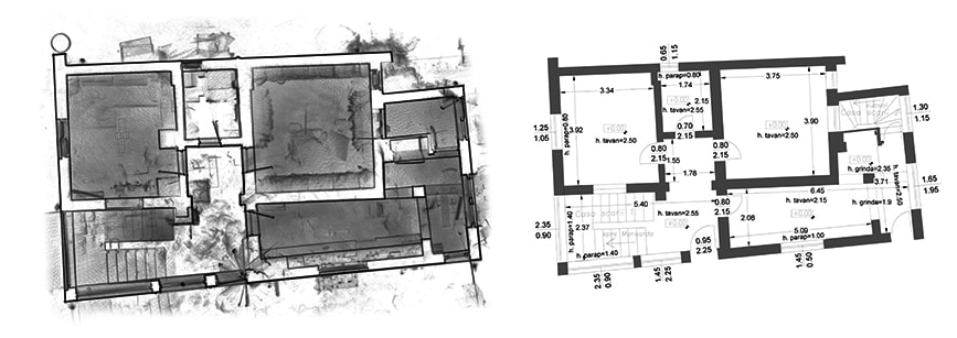
As-built surveys
As-built surveys are a core part of our building-measurement service, available for every type of project — from steel structures to historical buildings. A detailed floor plan captures the structural walls, the position and height of doors and windows, ceiling heights, beam locations and floor levels — for every storey.
We use a mobile laser scanner and a total station (for smaller projects, a digital tape measure too). On request we also produce reflected ceiling plans (lighting, CCTV, smoke detectors, HVAC) and roof plans. For areas unreachable from the ground, we use a drone-captured orthophoto.
What we deliver
- Floor plans (as-builts) for every storey of the building
- Reflected ceiling plans
- Roof plans (interior and exterior)
- Orthophotos and 2D/3D photographic records for unreachable areas
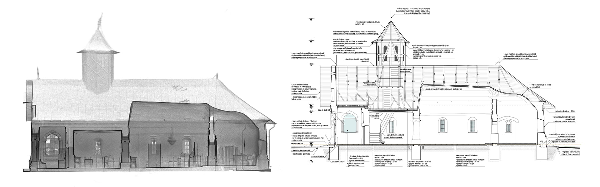
Building sections
Delivered as part of a measured-building project, section drawings offer a “direct” view straight through the entire building. They are delivered in 2D for every type of building, from steel structures to historical buildings.
Compiled from data captured by laser scanners, total stations or drones, cross-sections show the thickness of the void between a ceiling and the floor above, and the position of structural walls. They are used by architects, structural engineers and developers, and can be combined with elevation, floor and roof plans, or used to outline ground and watercourse profiles for flood-risk assessment.