3D SCANNING · UAV PHOTOGRAMMETRY · SURVEYING · CADASTRE
Fewer site visits, less design time, full confidence in your measurements. We deliver E57 point clouds, DWG plans and sections, Stereo 70 integration and orthophoto — everything you need to design with full information and no surprises.
- 500+ projects delivered
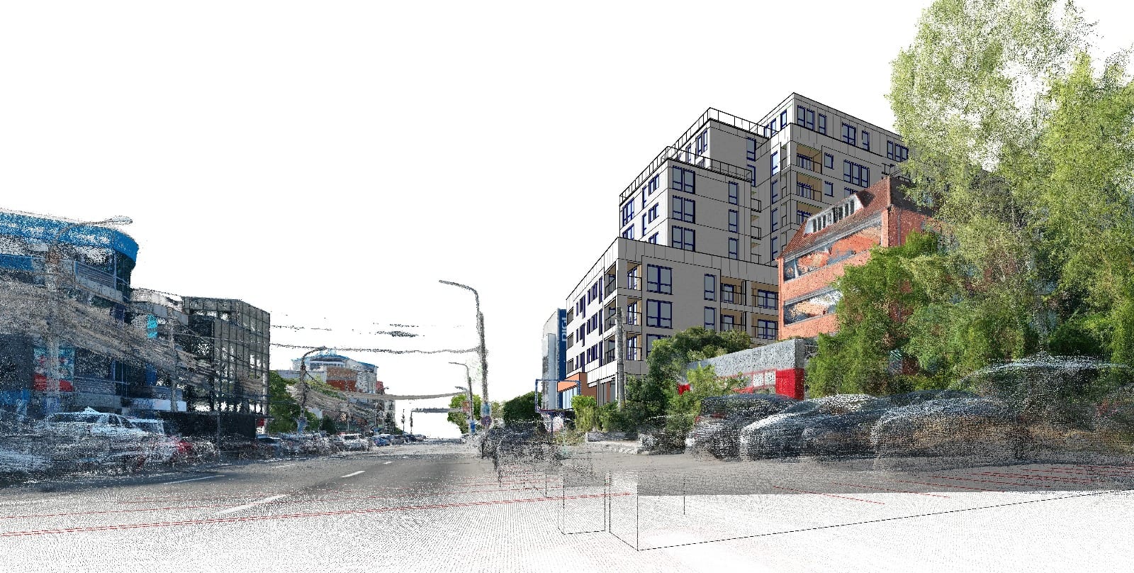
Accuracy and context
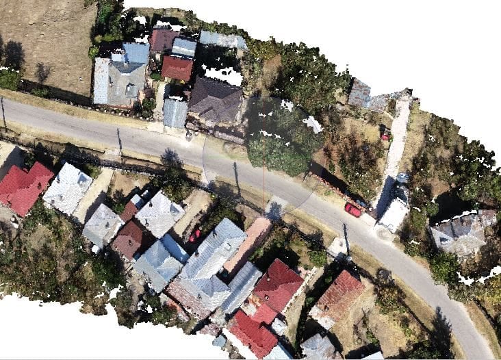
We capture and deliver the context you need from day one — setbacks, heights, urban integration.
Fast workflow
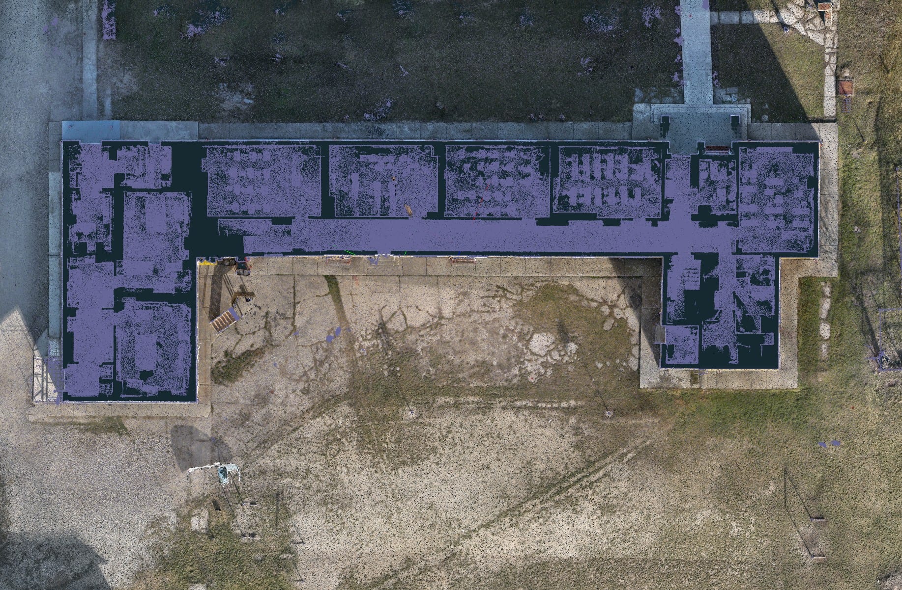
Survey, processing and deliverables in your working formats: E57, DWG, Stereo 70.
No re-surveys
Come back to the point cloud whenever you have a question. No repeated trips to site.
Ready to stop relying on a tape measure and uncertain drawings? See high-quality work.
Every project below started from real measurements on site, not from guesses. Browse the work and see exactly what you get before requesting a quote.
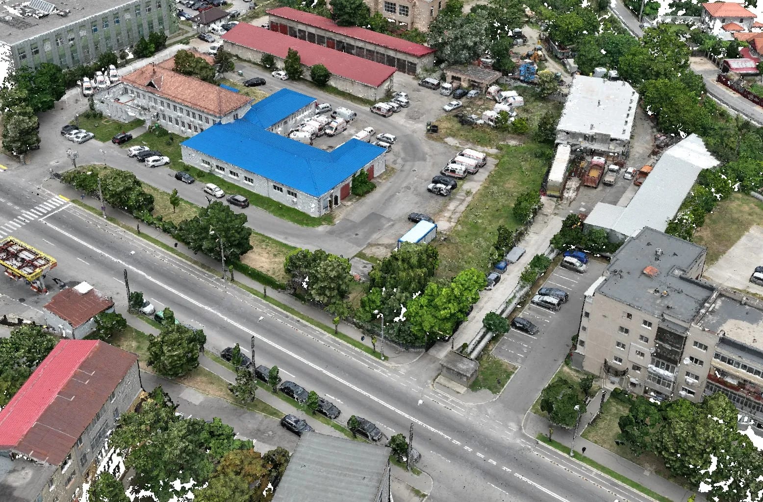
We turn reality into 3D data you can rely on.
We work with architects, developers and public institutions, delivering precise documentation in the formats you already use. From buildings and monuments to land and infrastructure, you get accurate, verified, ready-to-design 3D data.
Your challenges
- Manual measurements that take a lot of time and are error-prone.
- Incomplete information from old 2D drawings.
- Costly risks and changes during construction.
Our solution
- Fast, complete 3D scanning — a faithful digital twin of reality.
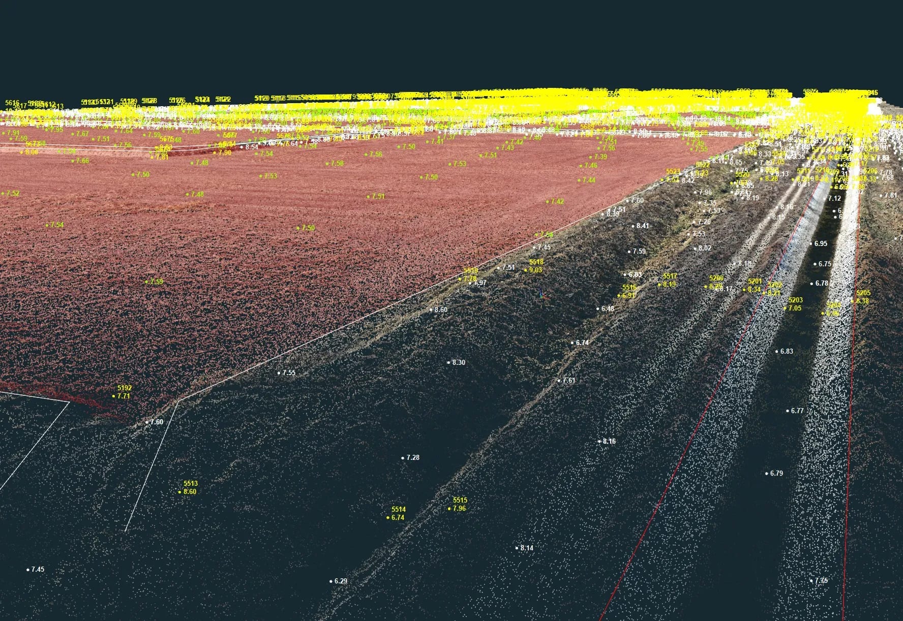
- Millimetre-level detail, from flatness to ornaments.
- Certainty and full control over the data you design from.
How we work
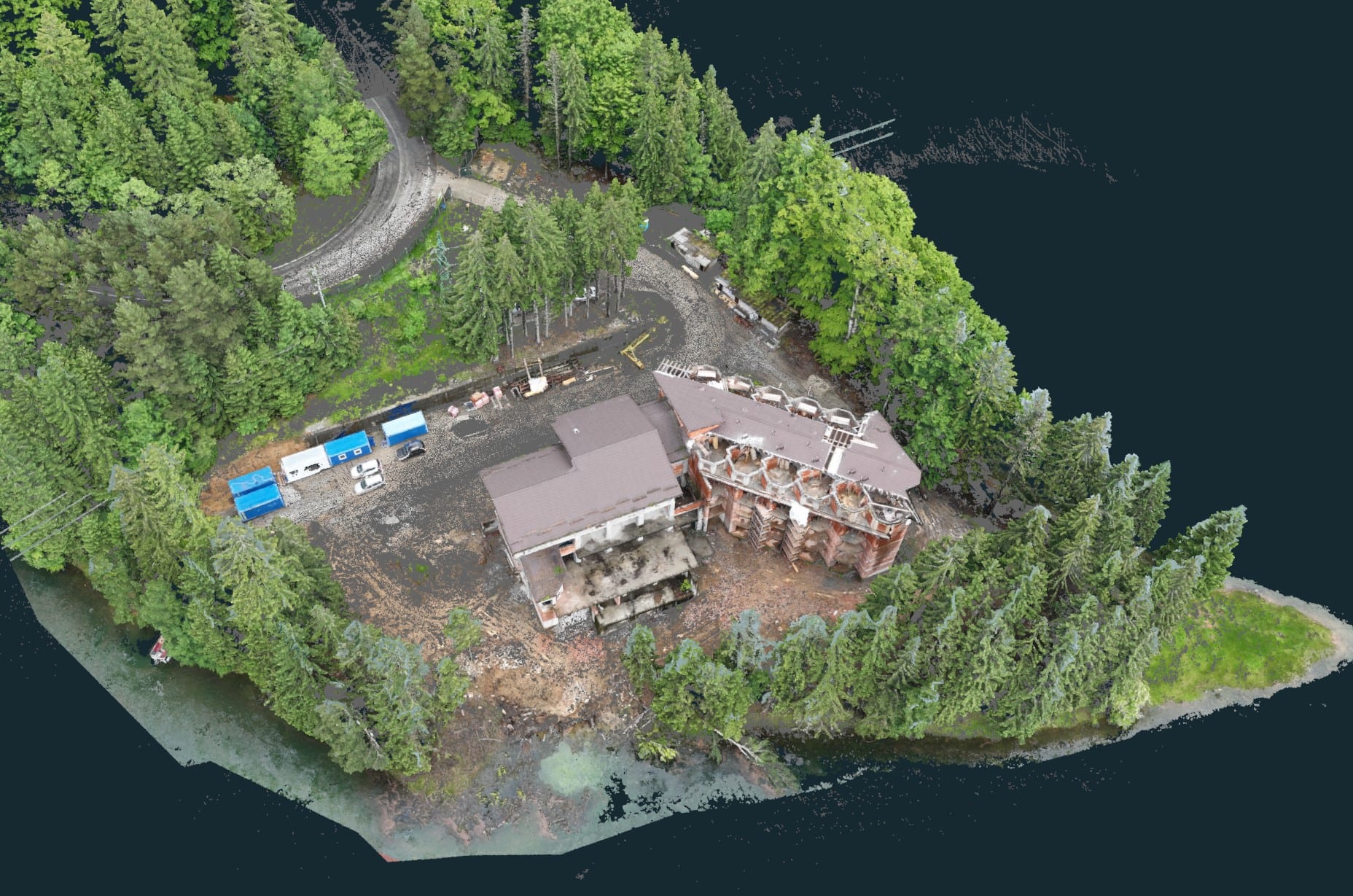
We measure on site
3D scanning, drone or classic surveying — we pick the method that fits your project.
We process and verify
Point clouds, models, plans and documentation — with QC checks so the data is correct.
We deliver in your formats
E57, DWG, Stereo 70, orthophoto — ready for design, permitting or land registration.
Ready-to-use deliverables
You receive E57, DWG, Stereo 70 and orthophoto files compatible with AutoCAD, Revit and ArchiCAD. No time lost on conversions or adjustments.
Accurate data, no surprises
3D scanning and photogrammetry with QC verification. You can trust the measurements and avoid costly deviations during construction.
Tens of hours saved
Full context from the start, with no repeated trips on site. Come back to the point cloud for any detail — design faster, with less stress.