UAV photogrammetry in Argeș
UAV photogrammetry in Argeș and across Romania — orthophoto, 3D models, DTM/DSM, heritage digitisation and façade drawings, from precision drone flights.
UAV photogrammetry
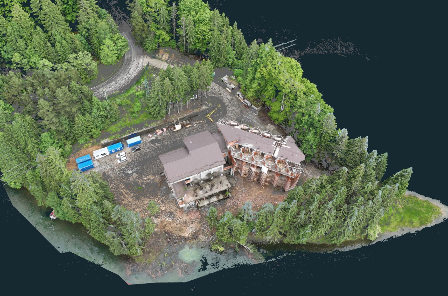
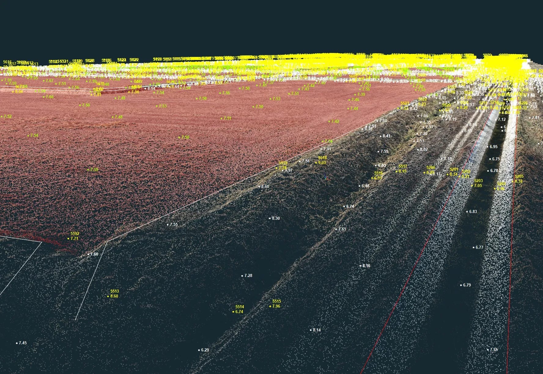
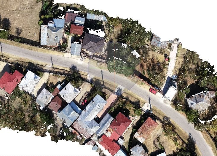
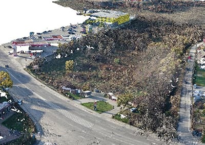
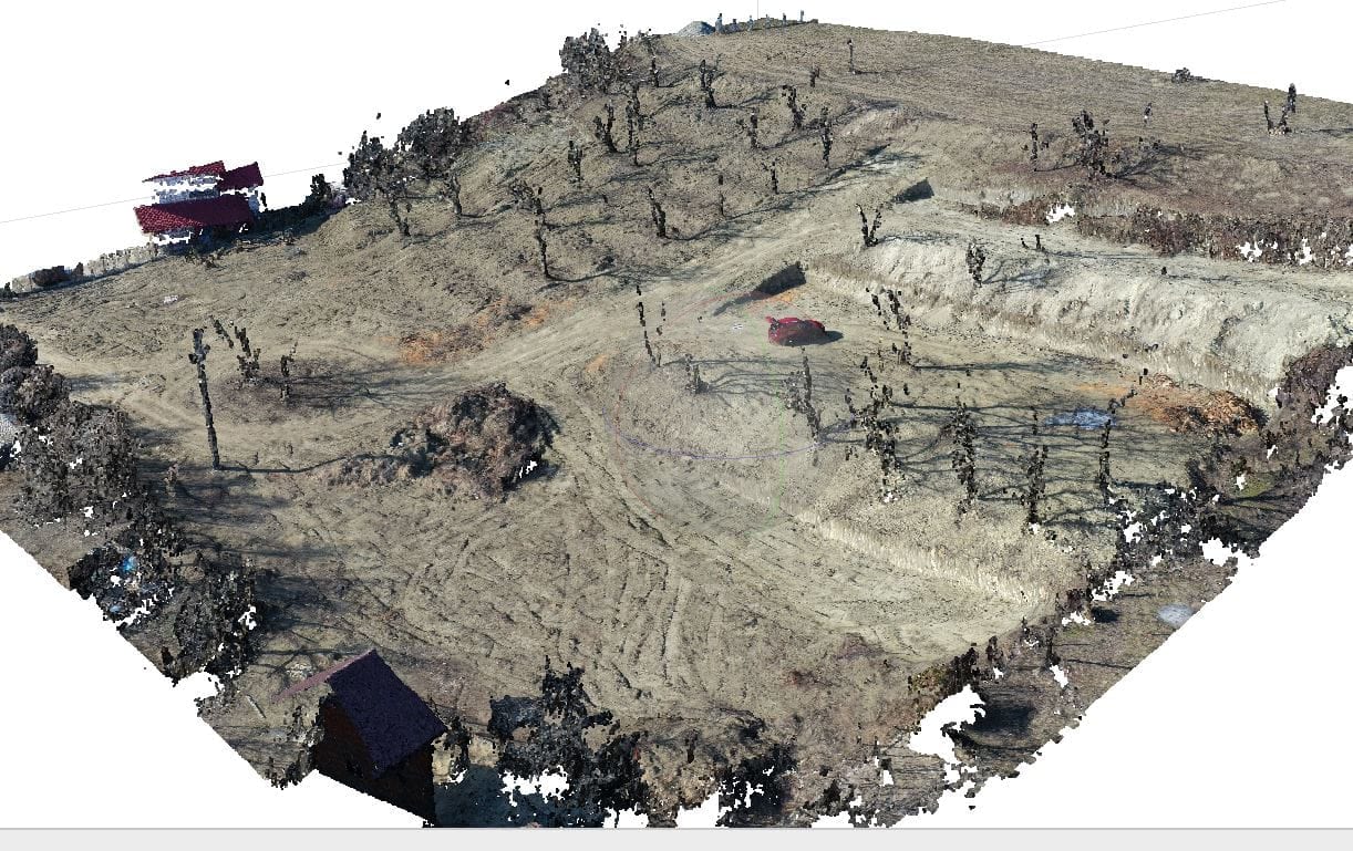
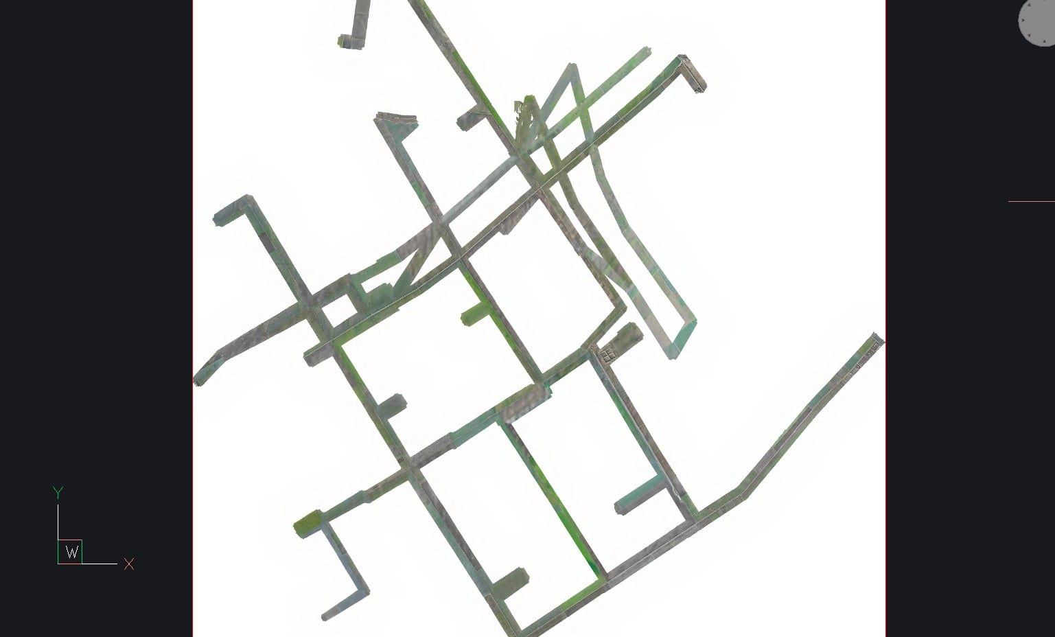
Drone photogrammetry reconstructs the terrain or a structure from dozens to hundreds of overlapping aerial photos, turned into a 3D point cloud and a georeferenced orthophoto. It is ideal for large areas, volume calculations (quarries, stockpiles), construction-site monitoring and fast topographic surveys.
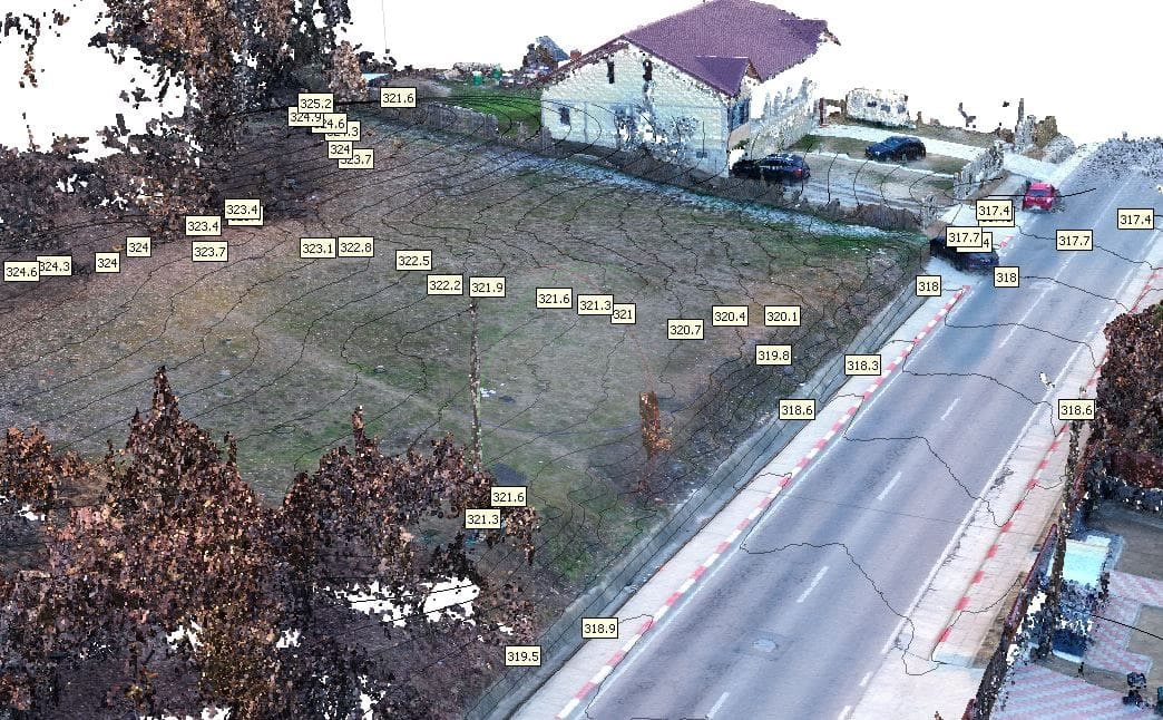
Our UAVs let us survey large or hard-to-reach areas efficiently — contactless, with high accuracy in three dimensions. From the in-flight imagery and/or laser-scan data we process a 3D point cloud, then derive georeferenced orthophotos and digital terrain models. With GIS, CAD or BIM software we produce colour topographic maps and site plans.
Working from the 3D point cloud we also compute precise volumes — for stockpiles, storage areas, quarries or construction sites — and we can document volume change across two flights flown at different dates.
What we deliver
- Point clouds resulting from the 3D survey / 3D documentation
- Orthophotos from various angles — e.g. of façades, towers or bridges
- Georeferenced ground-surface orthophotos at multiple scales and resolutions
- Digital terrain models
- 3D modelling and 2D drawings
- Volume determination
- Project progress monitoring
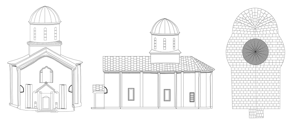
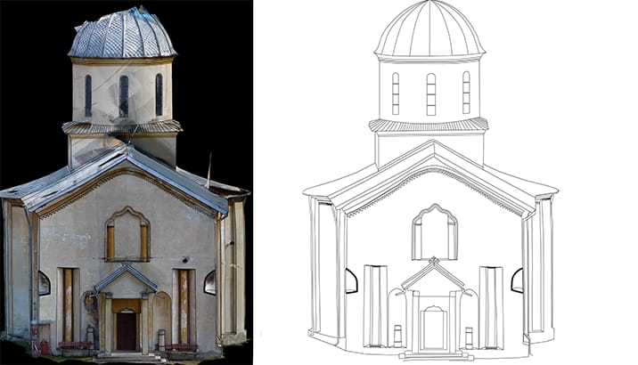
Heritage digitisation
Our UAV services for heritage protection and cultural-asset digitisation cover contactless measurement, inventory and three-dimensional documentation of heritage objects, using UAV photogrammetry and 3D laser scanning.
What we deliver
- 3D measurement by drone using UAV photogrammetry and UAV laser scanning
- Inventory capture and three-dimensional documentation by drone
- Stone-by-stone façade measurement using UAV photogrammetry
- True-scale, high-resolution façade documentation
- 3D measurement and digital inventory using terrestrial laser scanners
- Contactless capture of listed buildings
- Inventory survey using UAV and terrestrial photogrammetry
- High-resolution 3D scans of artefacts
- Fast, cost-effective 3D inventory using mobile laser scanning
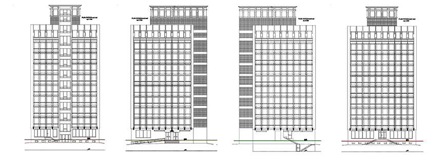
Façade drawings
We produce drawings of the exterior dimensions (orthophotos, façades, roof) and the interior, for every type of building — from historical and heritage projects to private residences.
Capture relies on top-tier equipment: total stations, 3D laser scanners, drones and photogrammetry, often used in combination. Elevations can be delivered as a standalone project, and the measurements are usable by architects and engineers before any modification of the structure.