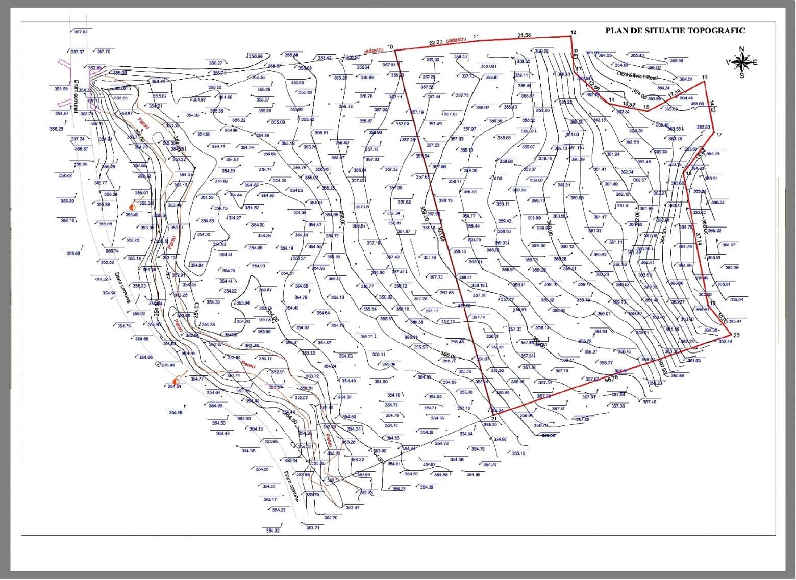
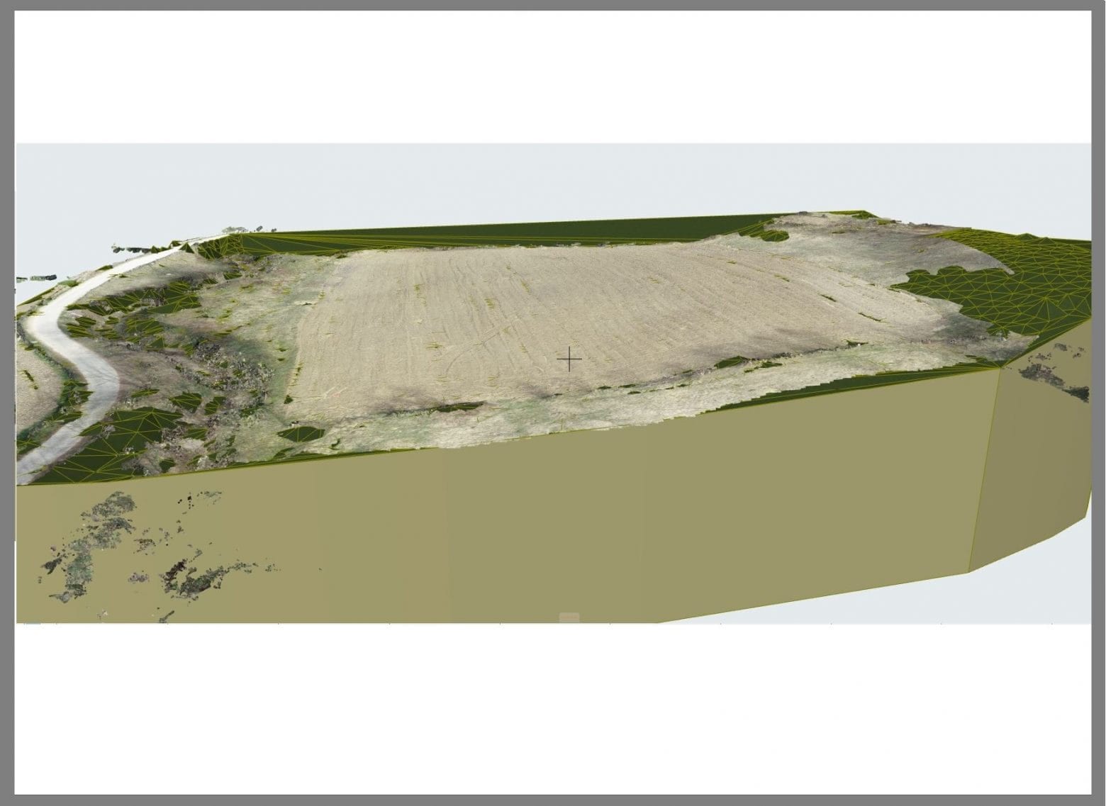
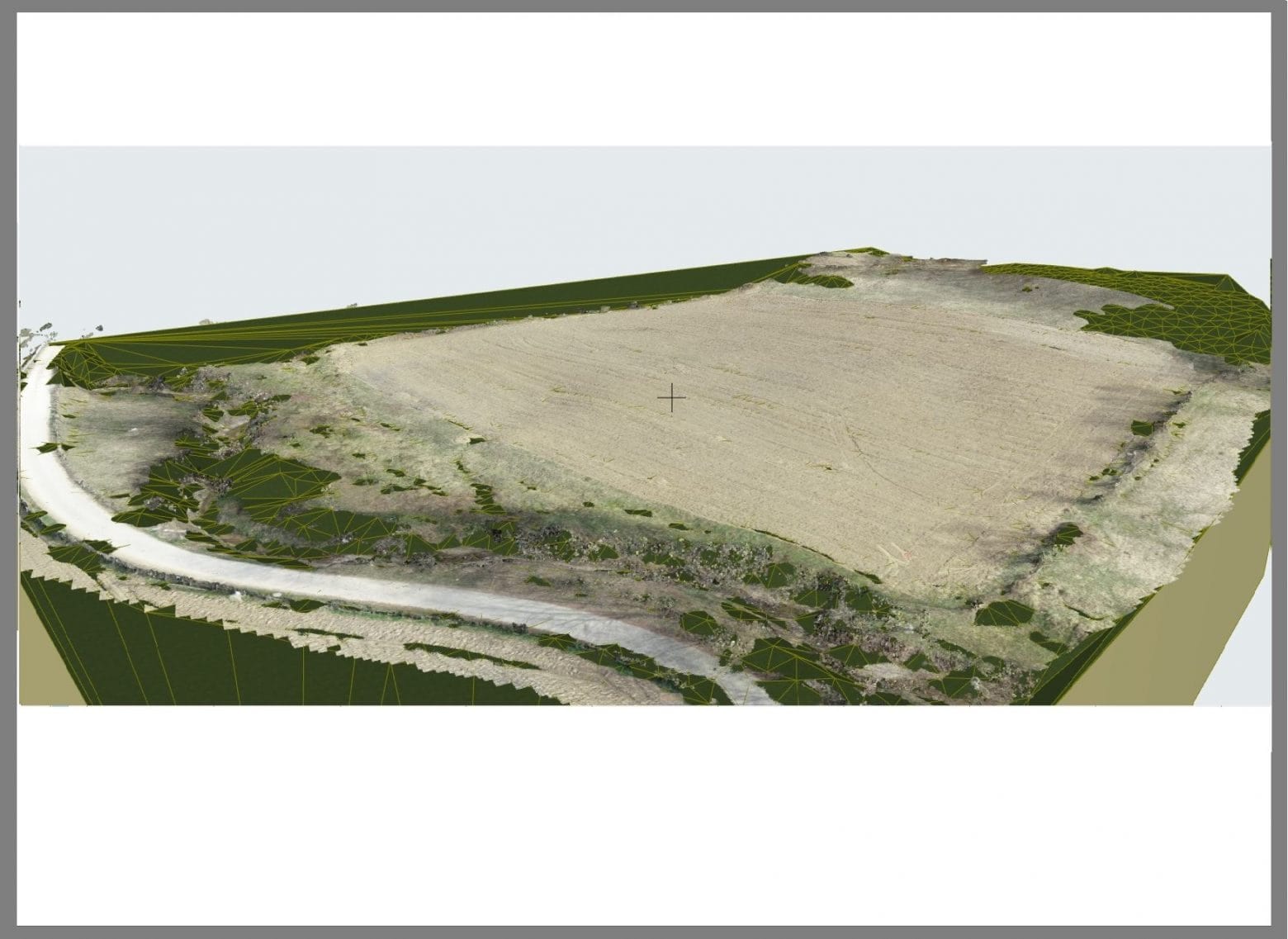
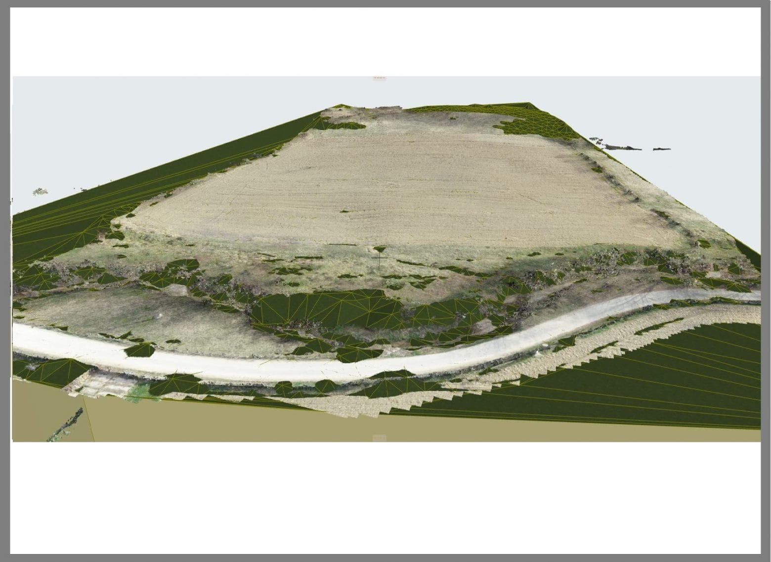
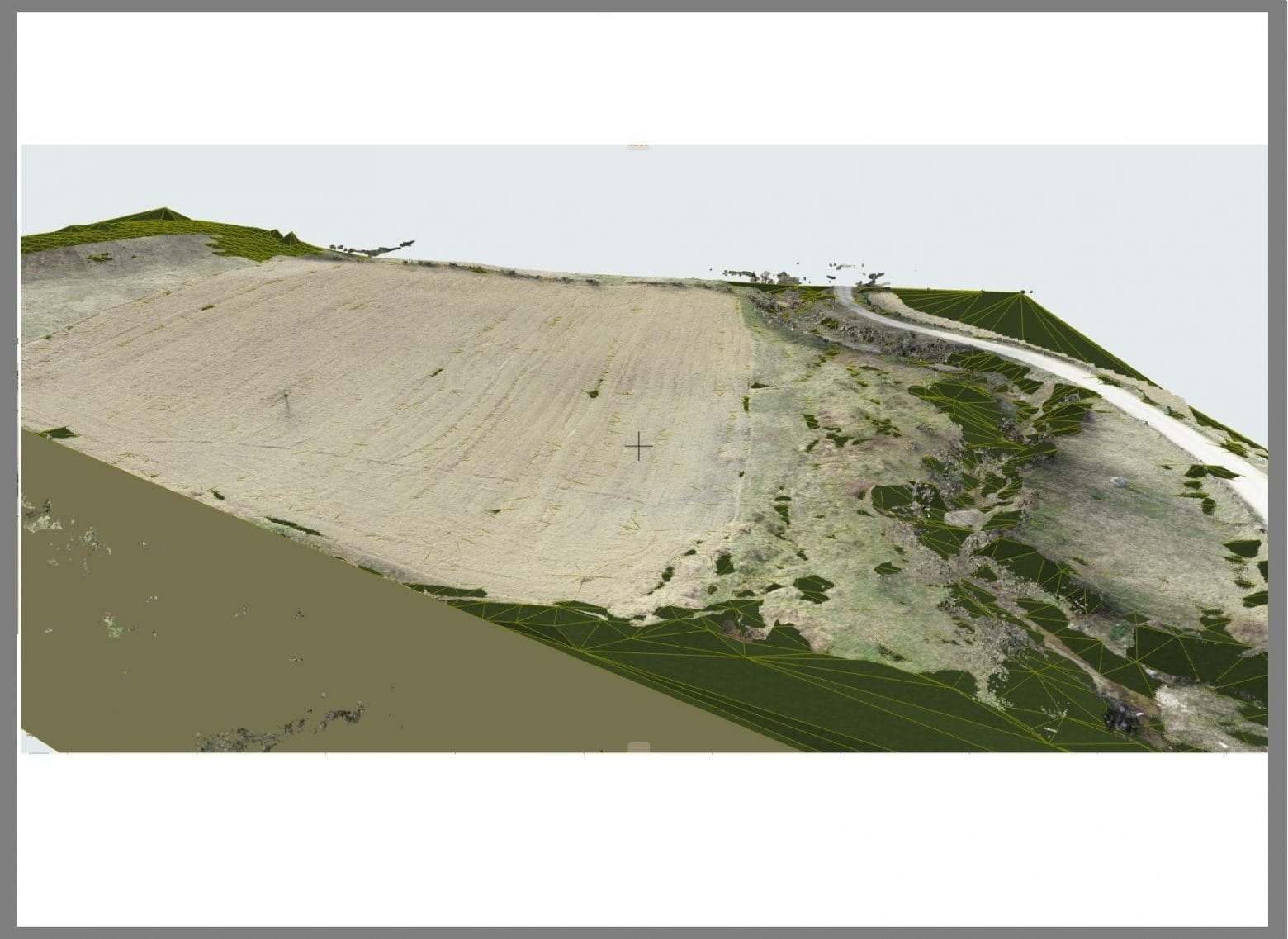
3D terrain scanning and modelling — zoning plan documentation
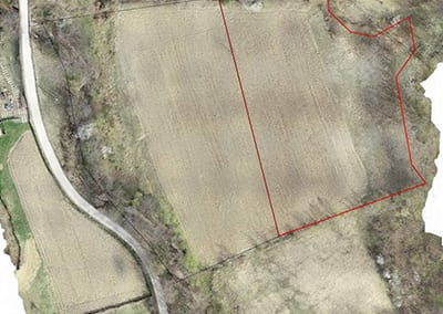
3D terrain scanning and modelling for a zoning plan (PUZ) documentation.
Deliverables
- un model de suprafață digitală (DSM)
- un model de teren digital (DTM) prin eliminarea obstacolelor supraterane
- cum ar fi arborii
- georeferențiat
- în culori realiste
- o hartă de înălțime
- curbe de nivel cu echidistanta de 10cm
- profiluri tranversale