3D topographic survey, 3D scanning, mesh, contour lines and drone orthophoto — residential area
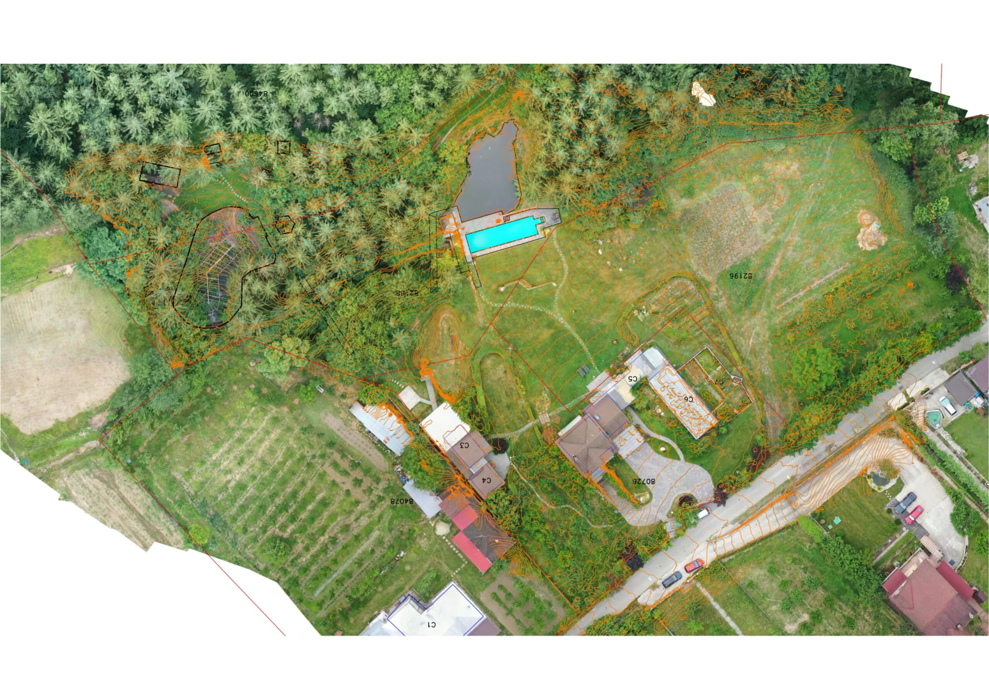
3D topographic survey, 3D scanning, mesh, contour lines and drone orthophoto for a residential area.
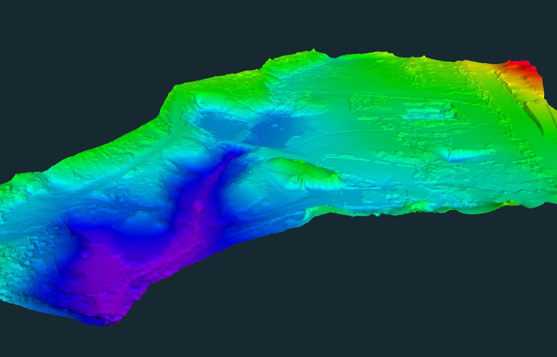
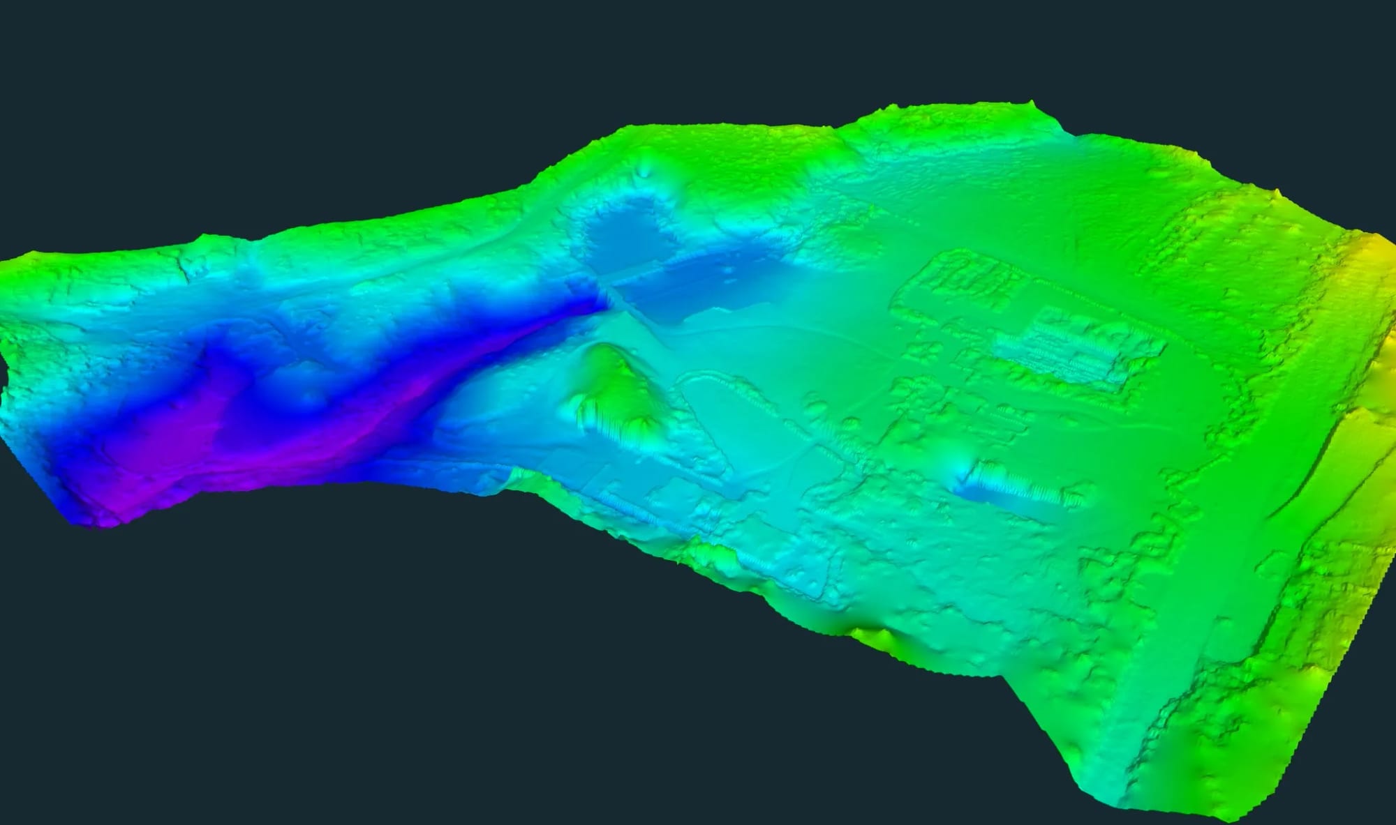
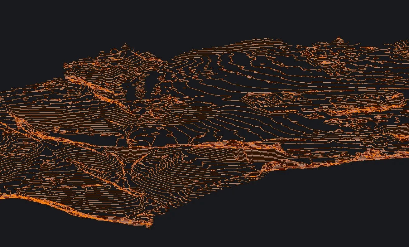
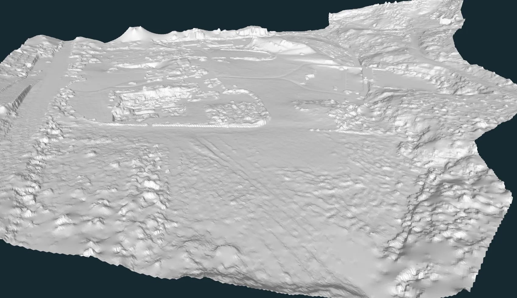
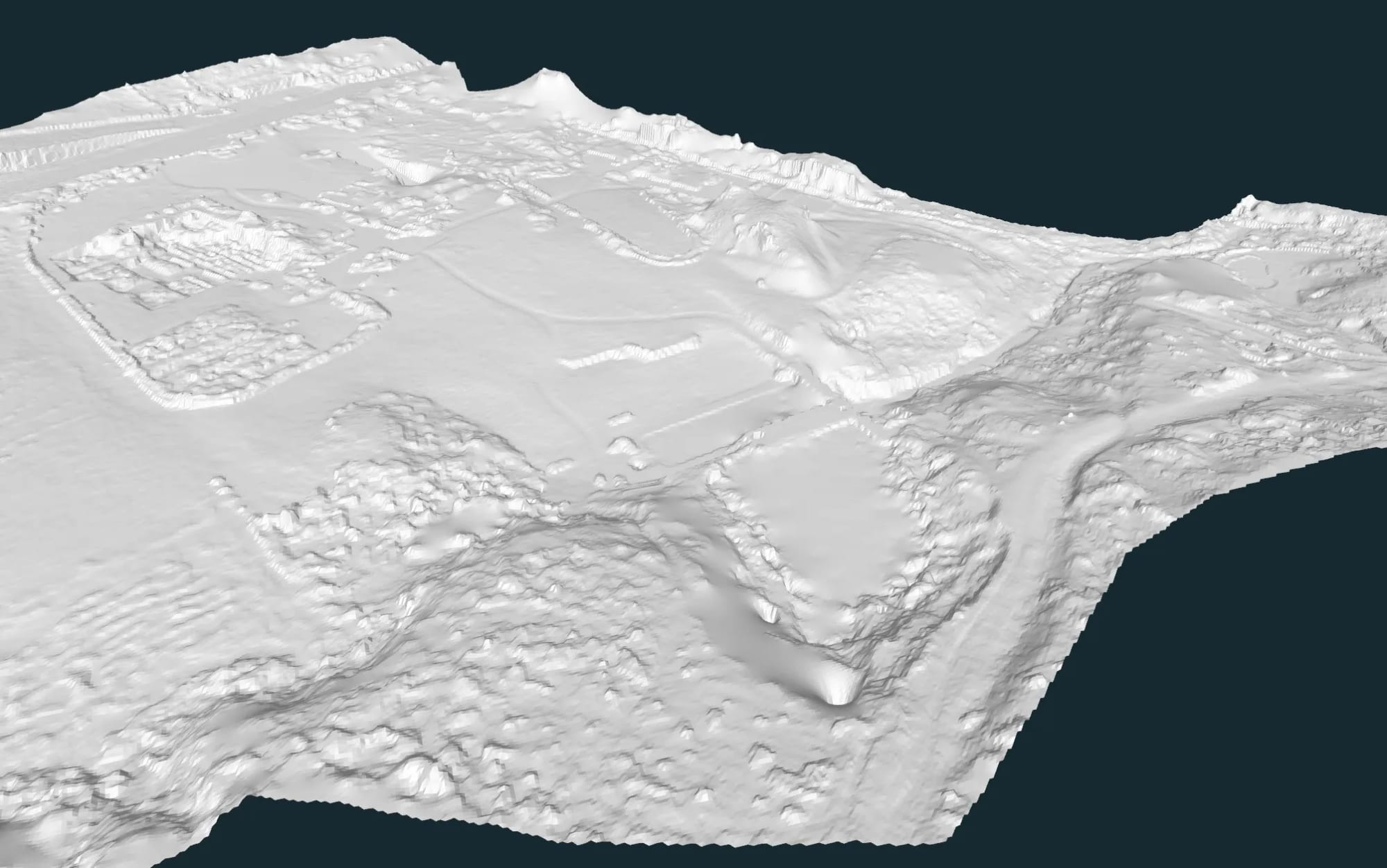
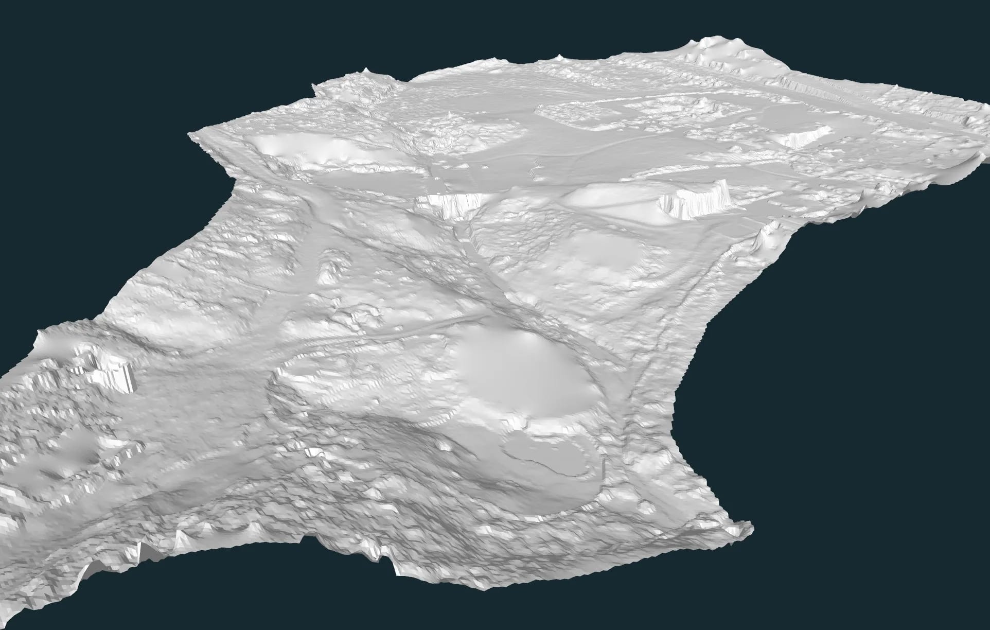
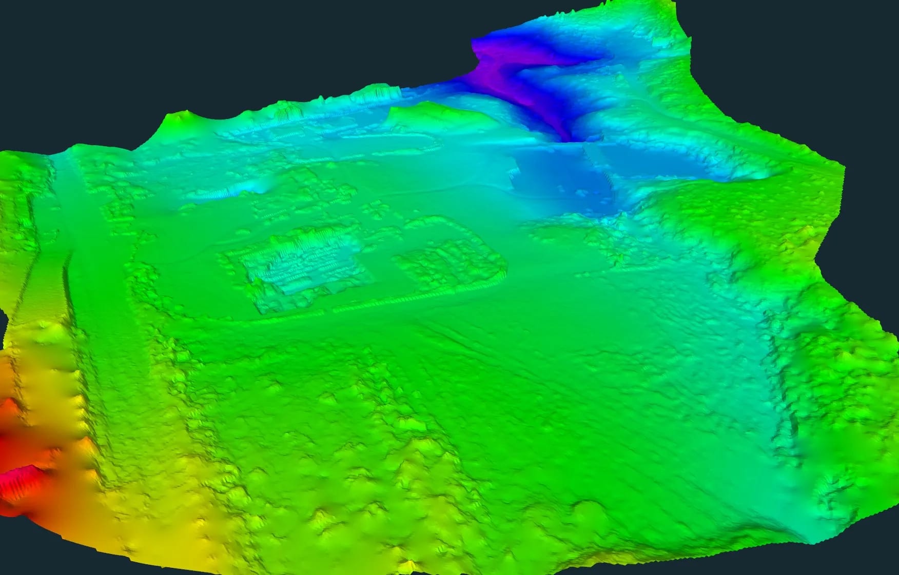
3D topographic survey, 3D scanning, mesh, contour lines and drone orthophoto for a residential area.
Tell us briefly the location, the area and the deliverables you need. We reply quickly with a technical proposal and realistic timelines.