3D topographic survey with tree positioning, 3D scanning of buildings and drone orthophoto — mountain area
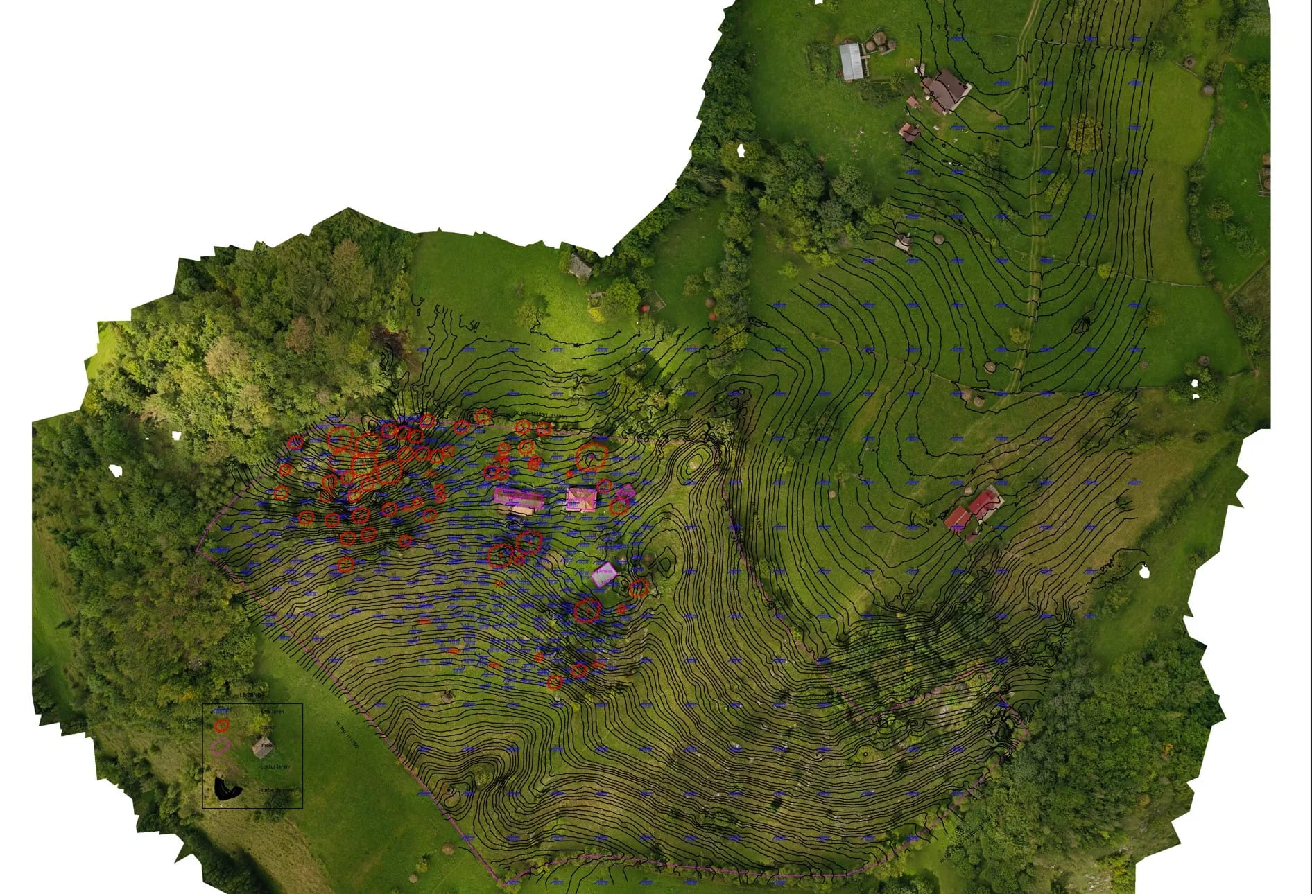
3D topographic survey with tree positioning, 3D scanning of buildings and drone orthophoto, in a mountain area.
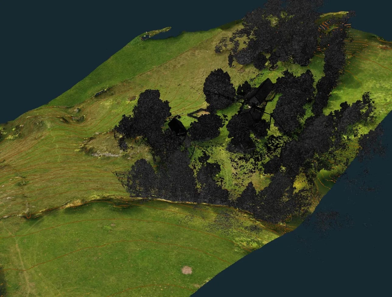
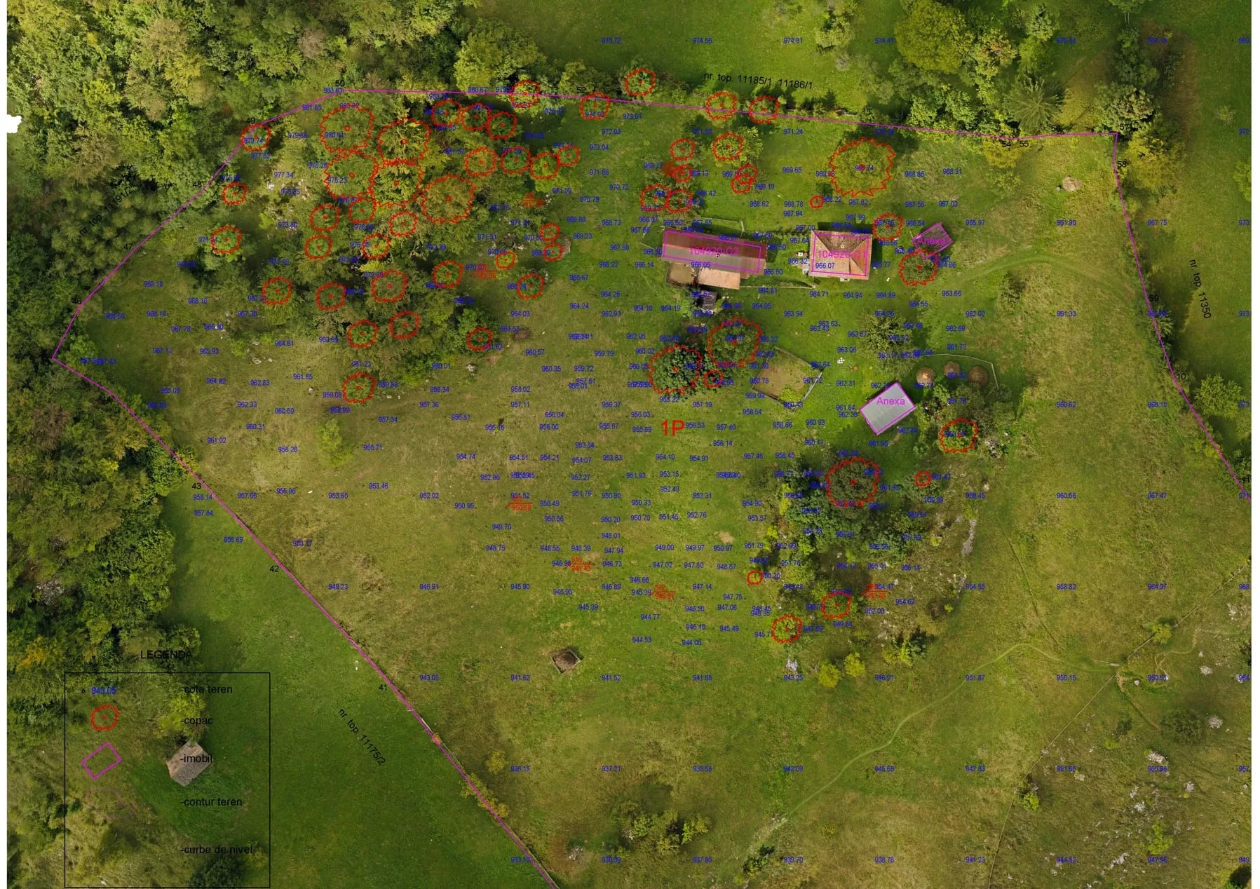
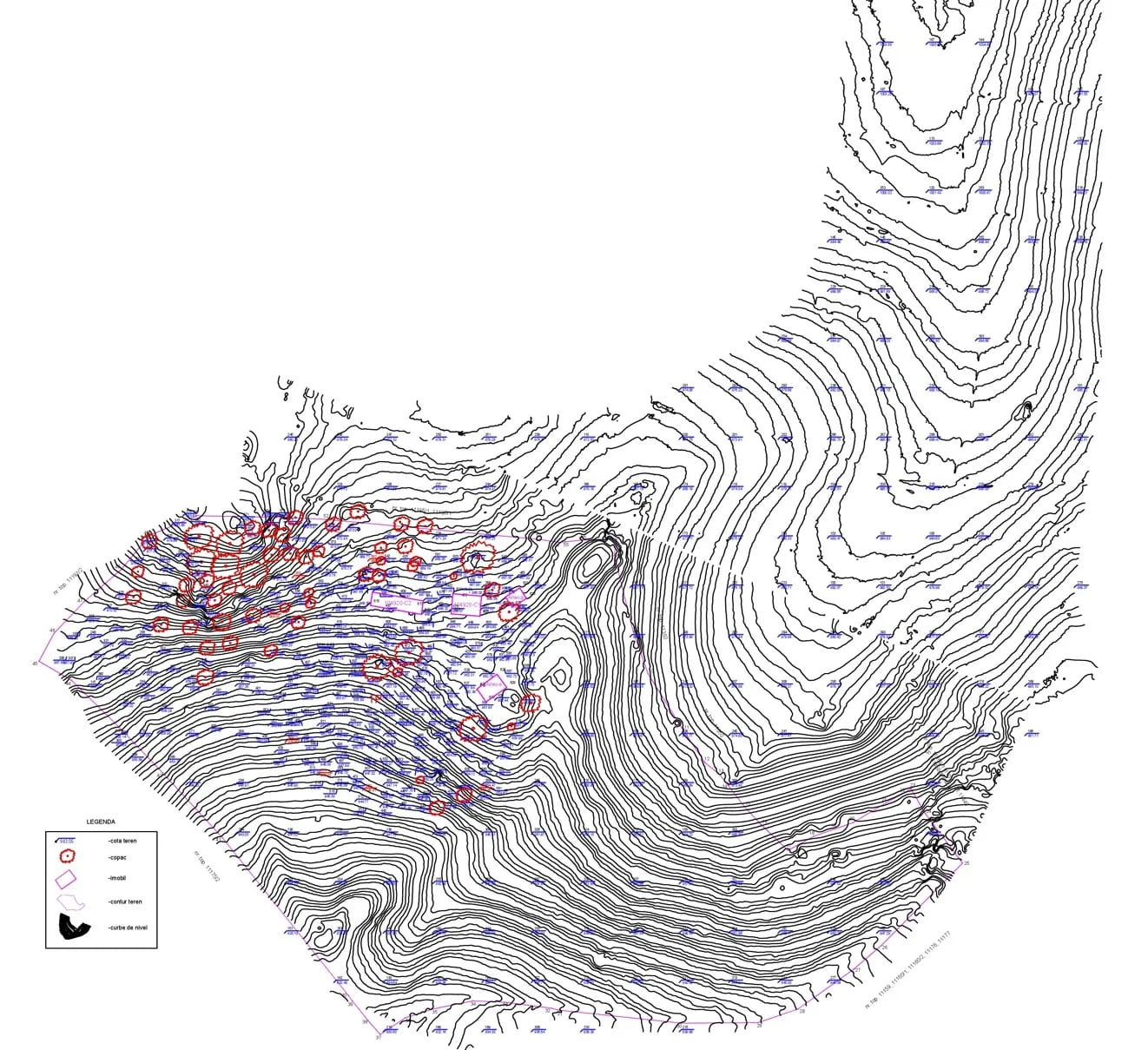
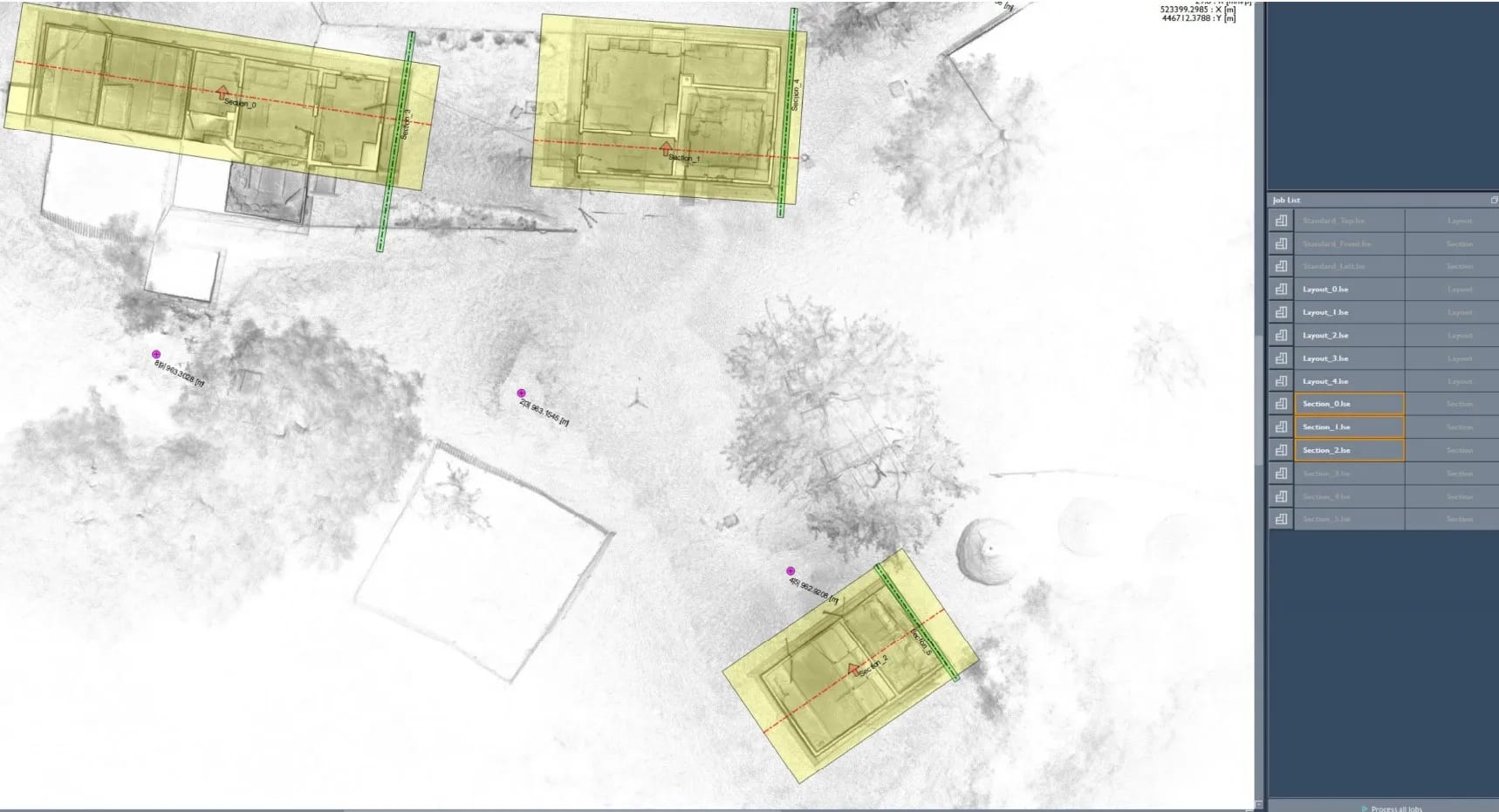
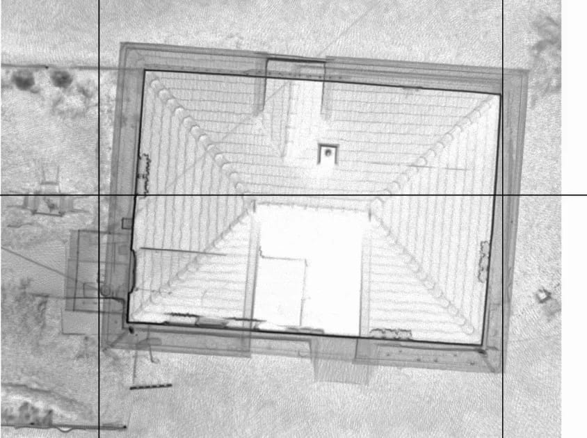
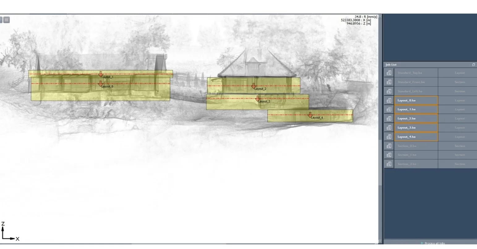
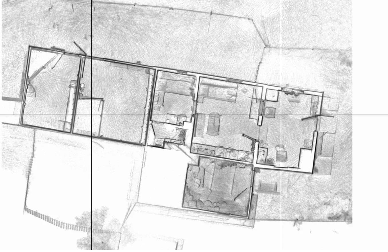
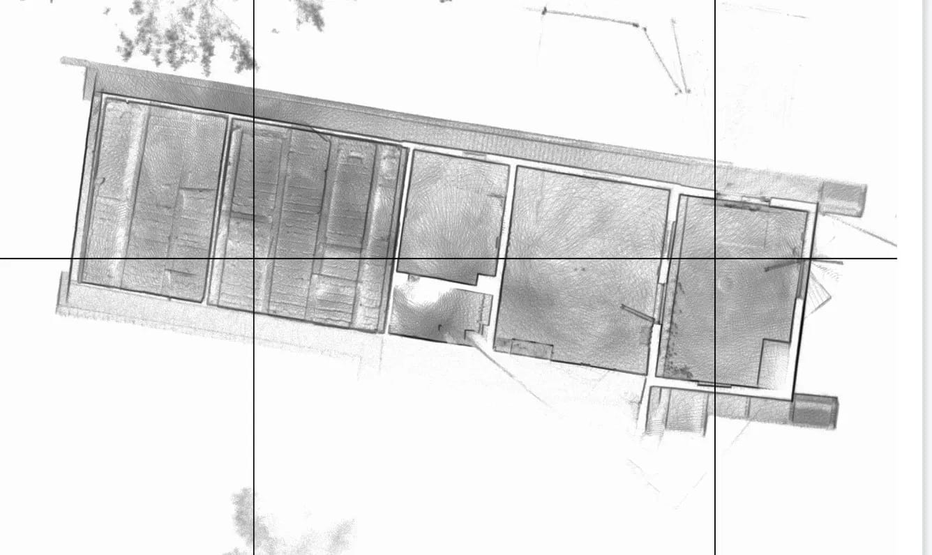
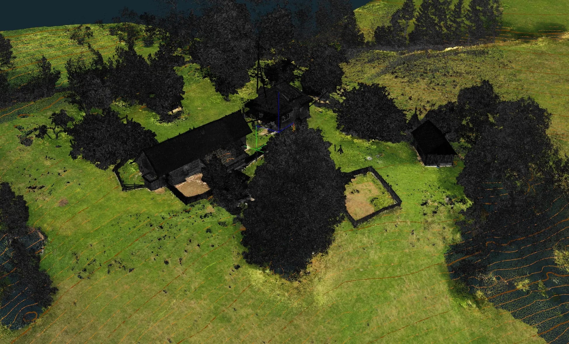
3D topographic survey with tree positioning, 3D scanning of buildings and drone orthophoto, in a mountain area.
Tell us briefly the location, the area and the deliverables you need. We reply quickly with a technical proposal and realistic timelines.