Volumetric measurements with drones and LiDAR: precise volume calculations
Accurate volumetric measurements underpin any correct calculation of material stocks, ore reserves or earthworks. Drones and LiDAR (Light Detection and Ranging) technology have radically changed how volumes are determined: instead of slow, costly point measurements, they generate a dense point cloud of the entire surface, from which the volume is calculated automatically, with centimetre-level accuracy. This article explains how the two methods work, when each is chosen, and the advantages they bring over classical topography.
Drone photogrammetry for volume calculation
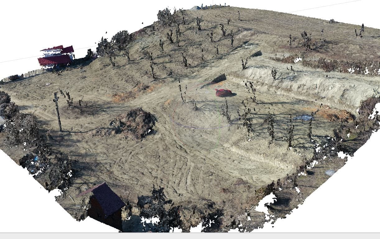
Drones equipped with high-resolution cameras fly over the area of interest and capture hundreds of overlapping images. Through photogrammetry, these images are turned into a 3D model and a point cloud from which the volume of stockpiles, spoil heaps or excavations is calculated. The method is particularly efficient on large or hard-to-reach surfaces, where it significantly reduces field time and operator risk exposure, while preserving the real texture and colour of the terrain.
LiDAR: precision and penetration through vegetation
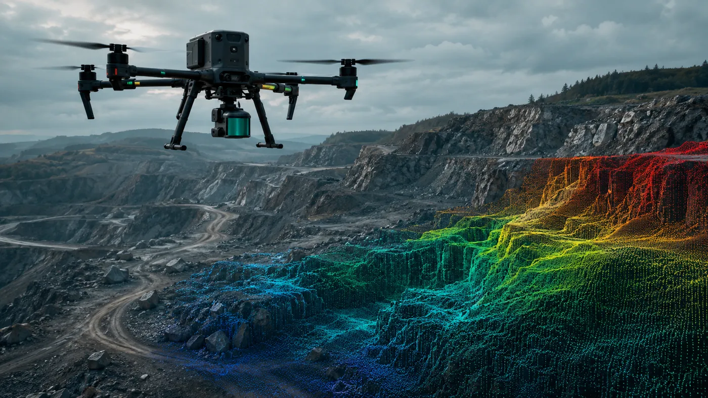
LiDAR uses laser pulses to measure distances and generates a very high-density point cloud. Mounted on a drone or on other platforms, it quickly scans large areas and offers a decisive advantage where photogrammetry struggles: in vegetated zones, where the laser beam penetrates between leaves to reach the ground, or in low-light conditions. The result is a clean digital terrain model (DTM), essential for accurate volumetric calculations.
Photogrammetry or LiDAR: how to choose the right method
- Drone photogrammetry is usually the more accessible solution and is preferred when surface texture and colour matter (aggregate stockpiles, spoil heaps, open quarries).
- LiDAR excels in densely vegetated areas, in poor lighting or wherever the highest ground-point density is required.
The choice depends on the specifics of the project, the type of terrain and the level of detail required. In practice, the two technologies are often complementary.
Practical applications of volumetric measurements
- Mining and quarrying: estimating ore reserves and monitoring topographic changes during extraction.
- Construction and earthworks: planning ground works and evaluating the quantities of material excavated or brought in.
- Waste management: measuring volumes at landfills and complying with environmental regulations.
- Stockpile inventory: periodic verification of aggregate, ballast or biomass stockpiles.
Conclusion
Drones and LiDAR offer volumetric measurements that are fast, accurate and more accessible than traditional methods, and the choice between them depends on actual terrain conditions and the required level of detail. If you have a volume to calculate — a stockpile, a quarry or an earthworks site — we can help with a drone survey and a documented volumetric calculation. Request a quote.