3D scanning and photogrammetric drones in urban planning
Good urban planning starts from an accurate understanding of the territory: relief, existing buildings, infrastructure. 3D scanning and photogrammetric drones provide this faithful picture, as 3D models and orthophotos on which architects and planners can work directly. This article shows how these technologies support more precise, faster and more sustainable urban planning.
Urbanisation and the need for accurate data
Urbanisation — the expansion and densification of urban areas — brings progress but also challenges around resource and environmental management. Efficient planning, based on accurate data about land and buildings, is essential for a durable and comfortable city.
3D scanning in urban planning
3D scanners capture spatial data quickly and accurately, allowing detailed models of existing land and buildings to be created. These models support the analysis and design of urban spaces, reduce errors and save time — a clear advantage especially in the refurbishment of built-up areas, where the existing geometry must be known precisely.
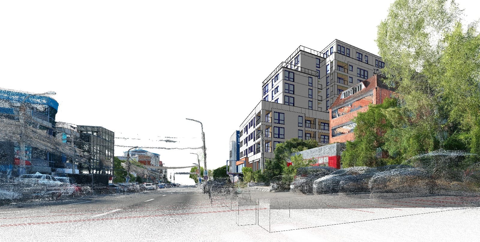
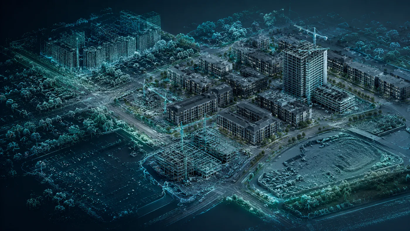
The photogrammetric drone in urban planning
The photogrammetric drone, equipped with high-resolution cameras and sensors, captures aerial imagery and topographic data over large surfaces. It produces orthophotos and 3D models useful for mapping and monitoring urban projects, including in hard-to-reach areas, offering a comprehensive perspective on the territory.
Integrating the two technologies
Combining data from the 3D scanner (detailed geometry, at ground level and indoors) with data from the photogrammetric drone (aerial coverage over large surfaces) leads to a complete understanding of the terrain and existing conditions. This integration enables more precise planning and more efficient implementation of urban projects.
Conclusion
3D scanning and drone photogrammetry streamline planning and contribute to more sustainable urban spaces, adapted to the changing needs of communities. For 3D models of an urban site, orthophotos or scans of existing buildings, contact us — we put the data the project needs at its disposal.