UAV aerial photogrammetry: modern measurements from a drone
UAV aerial photogrammetry is one of the most efficient modern measurement methods in cadastre and topography. With dedicated UAV (Unmanned Aerial Vehicle) drones and latest-generation equipment, 3DMaps delivers centimetre-level measurements, very useful when studying a piece of land or a building. This article explains what UAV photogrammetric technology is, the services it supports, and the equipment and software we use.
Individuals, companies, organisations, associations or public institutions can rely on 3DMaps for a wide range of services: UAV photogrammetry, 3D scanning of buildings, terrestrial measurements, topographic surveys, heritage digitisation, façade as-built surveys and drawings — delivered by experienced professionals with next-generation equipment.
What UAV photogrammetric technology is
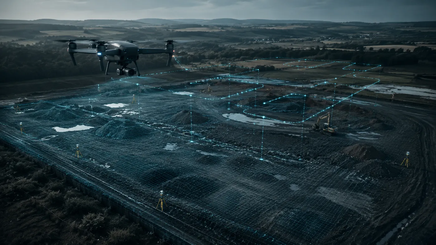
Because the pace of construction is ever faster, the 3DMaps specialists obtain the data required for topographic studies quickly and efficiently through aerial photogrammetry. Dedicated UAV drones gather all the necessary information, reducing the cost, the number of people involved and the time normally allocated to such an analysis.
Through UAV technology we offer, among other things: topographic plans with contour lines, cadastral studies, volume calculations, integrity inspections of installations and machinery in hard-to-reach areas, monitoring in forestry and agriculture, construction-site monitoring, 3D models and reconstructions, study of heritage monuments or archaeological sites, real-estate photography and perimeter surveillance.
Equipment and software used in UAV photogrammetry
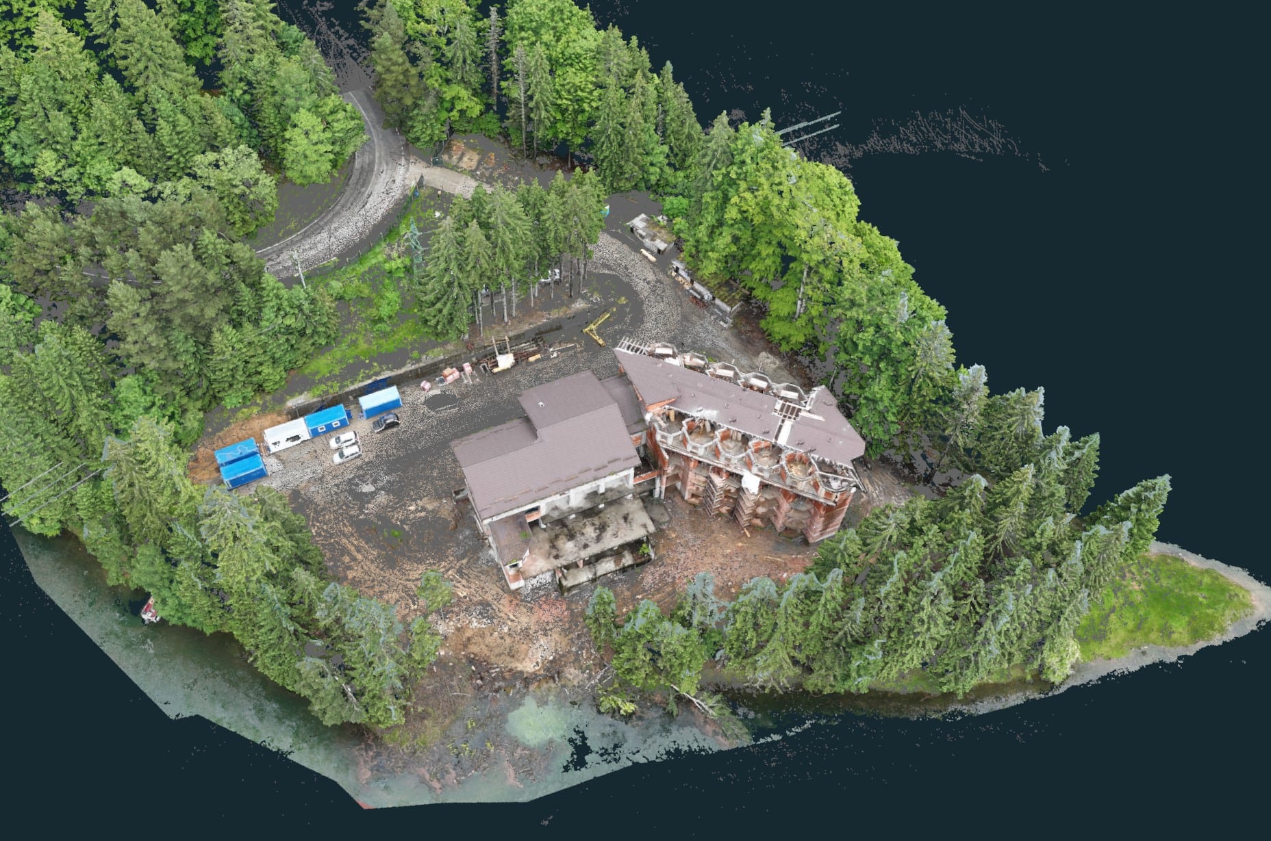
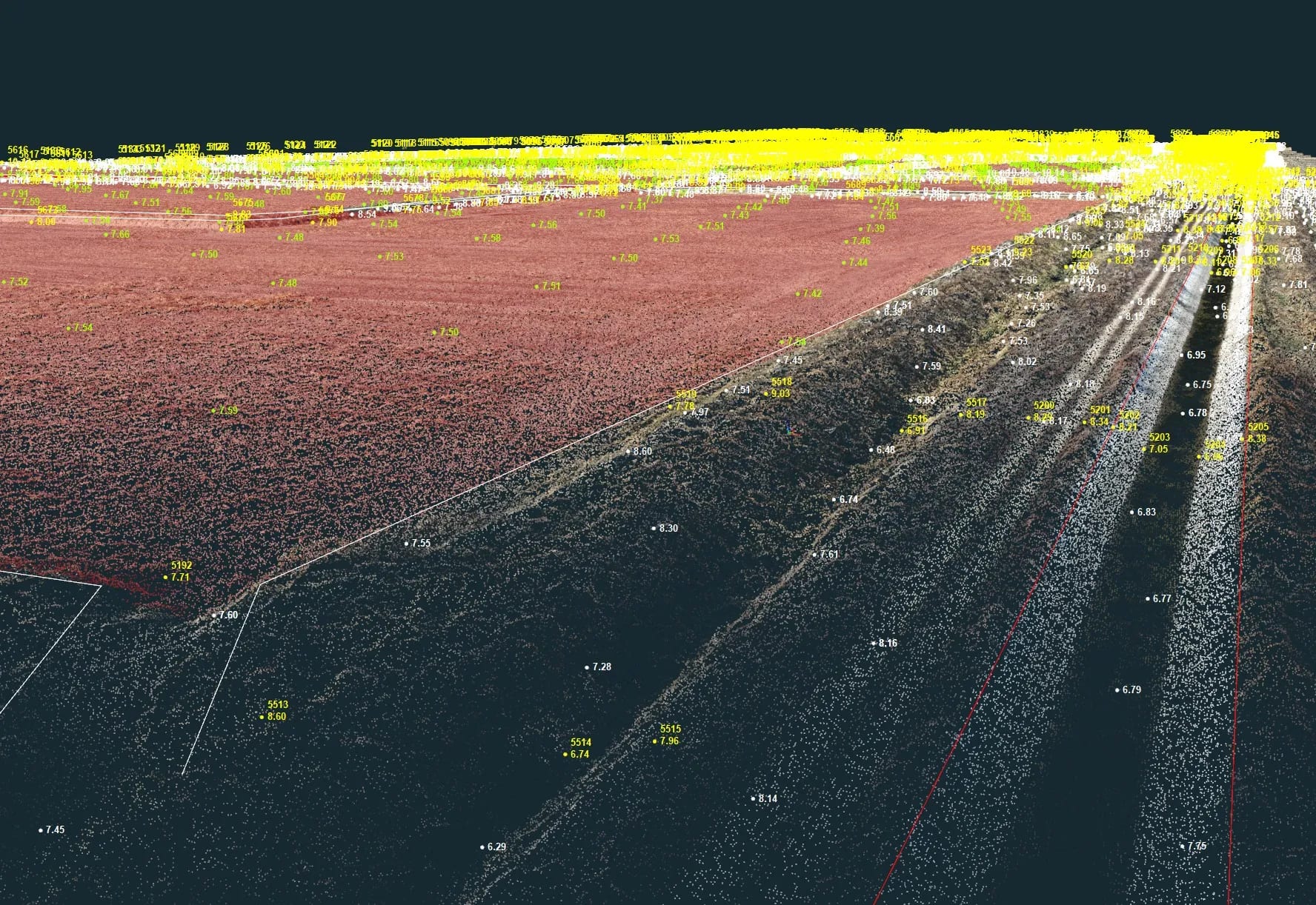
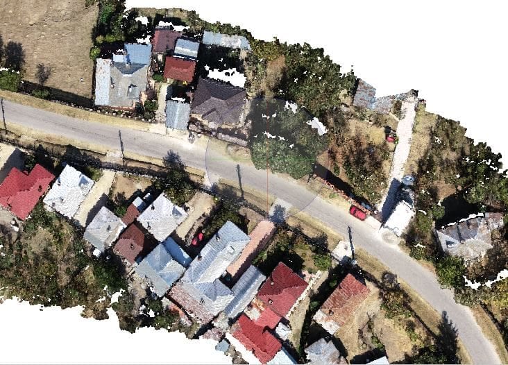
3DMaps UAVs measure large, hard-to-reach areas contactless yet with high accuracy. During the flight, photographs are taken which, together with the laser scans, are processed into a 3D point cloud — the basis for georeferenced orthophotos. CAD, GIS or BIM software is then used to create topographic maps, as-built plans or site plans.
Deliverables produced from point clouds
- orthophotos from detection angles — bridges, façades, towers;
- georeferenced orthophotos of the terrain, in various resolutions and scales;
- 3D modelling and 2D drawings;
- digital terrain models;
- target / actual comparisons for verification and consumption calculation;
- point clouds from 3D measurements or 3D documentation;
- determination of mass and volume;
- calculation of cut-and-fill volumes;
- measurement of a project’s progress;
- monitoring of slope movement.
The point cloud represents surface structures and complex objects through individual points in a 3D coordinate system. The points recorded through photogrammetry or with a LiDAR scanner are turned, after processing, into a dense cloud from which additional results are derived: 2D maps, orthophotos, 3D terrain models.
3DMaps equipment
In day-to-day work, 3DMaps uses a GeoSLAM (captures and models complex data ten times faster than traditional measurements), a Geomax (full spectrum of satellite signals, full connectivity and functionality that allows the measurement of points impossible to obtain through classical methods), and BricsCAD software (a solution for architects, contractors and engineers, designed to improve the workflow and quickly create accurate building models).
Conclusion
UAV aerial photogrammetry delivers accurate, fast and cost-effective measurements for land and buildings. For a topographic plan, a volume calculation or a drone orthophoto, contact 3DMaps.