Orthomosaics and orthorectification in drone photogrammetry: a practical guide
The orthomosaic (orthophoto) is one of the most widely used products of drone photogrammetry: a geometrically corrected, scaled aerial image on which you can measure distances and surfaces directly. Unlike an ordinary aerial photograph, an orthomosaic removes the distortions caused by relief and by camera tilt. This article explains what an orthomosaic is, how it is produced through drone photogrammetry, what orthorectification involves, and the advantages it brings in mapping and GIS systems.
What an orthomosaic (orthophoto) is
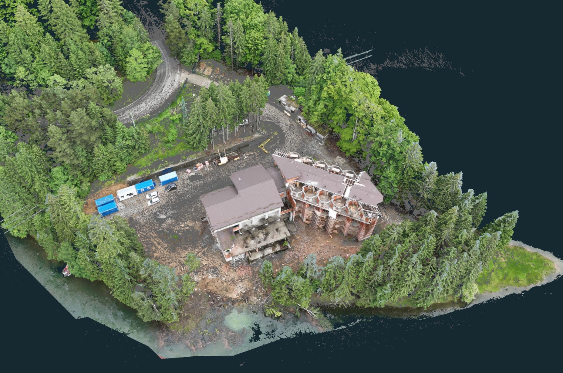
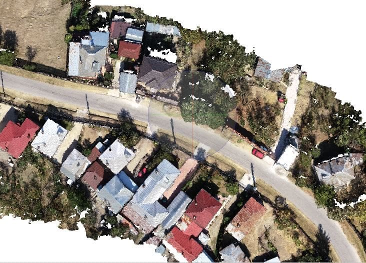
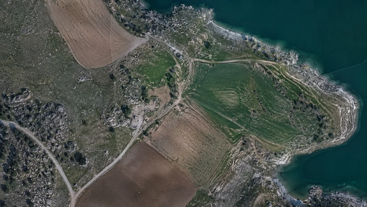
Orthomosaics are high-resolution, geometrically corrected aerial images, produced by stitching together several overlapping photographs captured by a drone. By removing relief and camera-tilt distortions, they deliver a faithful, scaled image of the terrain. They are used as accurate base maps in agriculture, construction, urban planning and environmental monitoring.
The fundamentals of drone photogrammetry
Drone photogrammetry starts from aerial images captured with high-resolution cameras mounted on the drone. The images are processed to produce 3D models, maps and orthomosaics. The method is often more cost-effective than drone LiDAR and is ideal for projects that need detailed, textured imagery of the terrain.
How an orthomosaic is produced, step by step
- Flight planning: altitude, image overlap and flight speed are set to ensure the quality of the final orthomosaic.
- Image capture: the drone, equipped with a high-resolution camera and GPS, follows the planned route.
- Image processing: specialised photogrammetry software stitches the overlapping images, corrects distortions and produces a georeferenced orthomosaic.
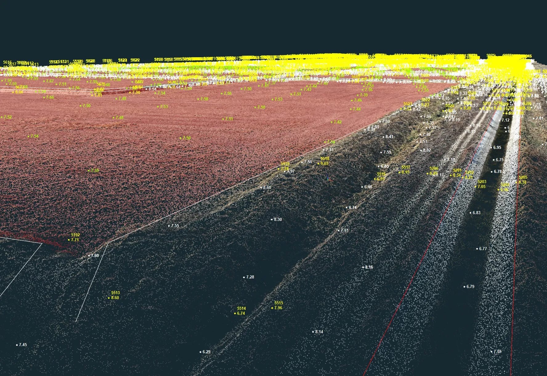
- Orthorectification: the final geometric correction, which accounts for the Earth’s curvature, camera tilt and relief variations, using ground control points (GCPs) and advanced algorithms.
Advantages of orthomosaics in mapping and GIS
- Spatial precision: high accuracy, essential for detailed mapping.
- Visual context: clear imagery of the terrain, useful also for interpreting LiDAR data.
- Temporal consistency: easy comparison between datasets captured at different times.
- Interoperability: straightforward integration into GIS systems alongside other geospatial data.
- Versatility: applicable from crop monitoring to construction-site planning.
Conclusion
Orthomosaics generated through drone photogrammetry offer an efficient and cost-effective way to obtain accurate, high-resolution 2D maps. For detailed mapping, they remain hard to match. If you need an orthophoto, a 3D map or drone mapping, contact us — we will deliver ready-to-use geospatial data.