Thermal-imaging drones: the most important practical uses
A drone equipped with a thermal camera detects and visualises temperature variations in a scene, which makes it useful across a wide range of fields — from security and search and rescue to industrial inspections and agriculture. This article reviews the most important practical uses of thermal-imaging drones and the concrete problems they solve.
Surveillance and security
The ability to detect thermal signatures makes it possible to identify people or objects in low-light or total darkness. A thermal-imaging drone thus becomes a valuable tool for securing perimeters at night and protecting assets and personnel.
Search and rescue
In natural disasters or accidents, thermal-imaging drones detect the heat signals emitted by missing persons, helping to locate and rescue them quickly — including in hard-to-reach areas.
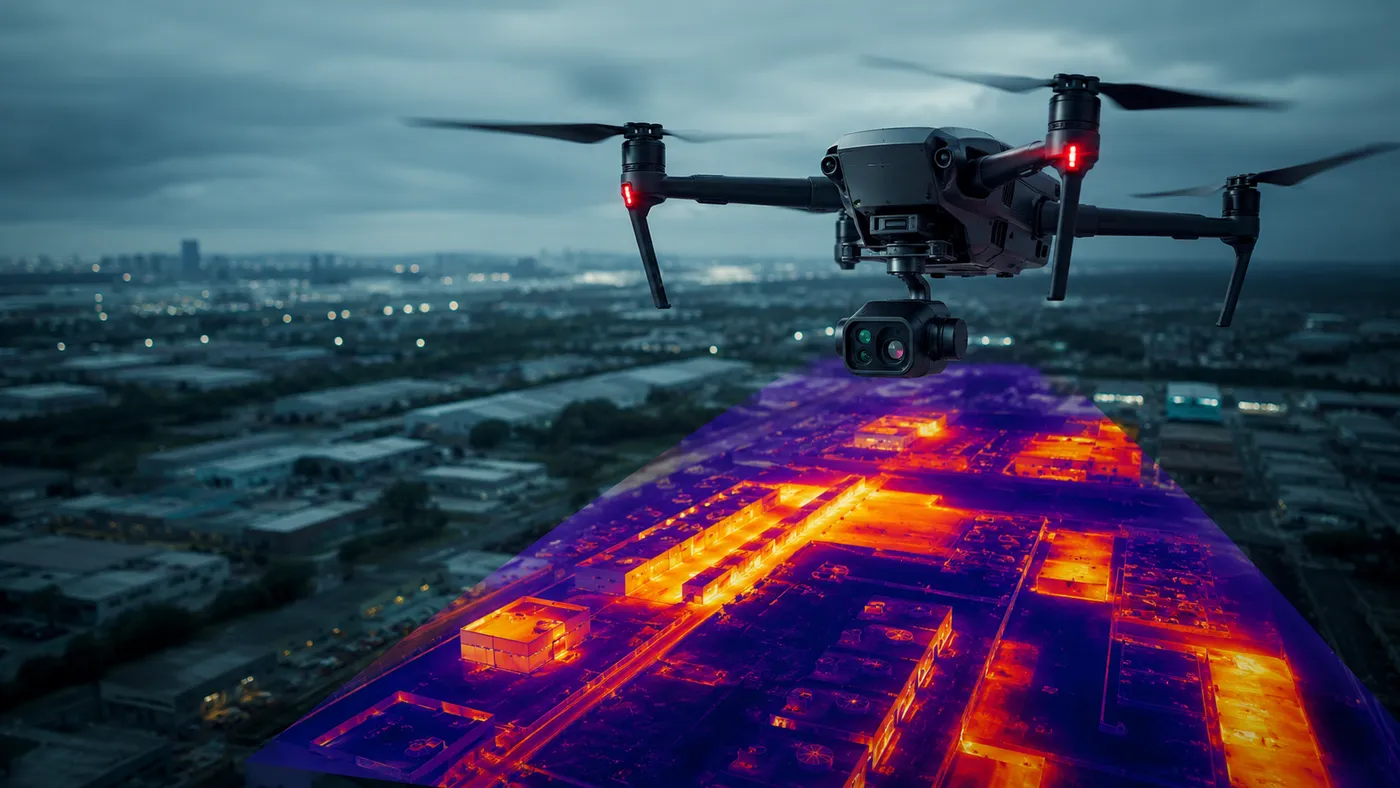
Infrastructure monitoring
Aerial thermography detects the hot spots that indicate overheating equipment or systems, supporting preventive maintenance and avoiding major failures on networks, pipelines or installations.
Agriculture
Through thermal monitoring of crops, drones provide farmers with information about plant health. Early detection of problems — diseases, lack of irrigation — allows fast intervention, increasing yield and reducing losses.
Industrial inspections
A thermal-imaging drone evaluates equipment, pipelines and structures thermally, efficiently identifying potential issues. It therefore helps prevent costly failures and improves safety in complex industrial environments.
Wildlife monitoring
Biologists and ecologists use thermal-imaging drones to identify species and gather data essential for biodiversity conservation, and to study animal behaviour and health.
Fire prevention and monitoring
In firefighting, thermal-imaging drones quickly detect fire fronts and monitor how a fire develops, giving response teams critical information for effective strategies.
Environmental monitoring
Aerial thermography supports the study of climate change, identifying areas with significant thermal variations and gathering data on thermal pollution and the impact of human activity on the environment.
Conclusion
Thermal-imaging drones have significant potential in many contexts, provided their use respects legal, ethical and privacy rules. For drone thermographic inspections — industrial, photovoltaic or on buildings — contact us.